Great Southern Brevet 2025
After a text from a friend that the registration page was live I was among the first 10 or so to sign up. The GSB is my favourite and not just because it was my first brevet back in 2021.
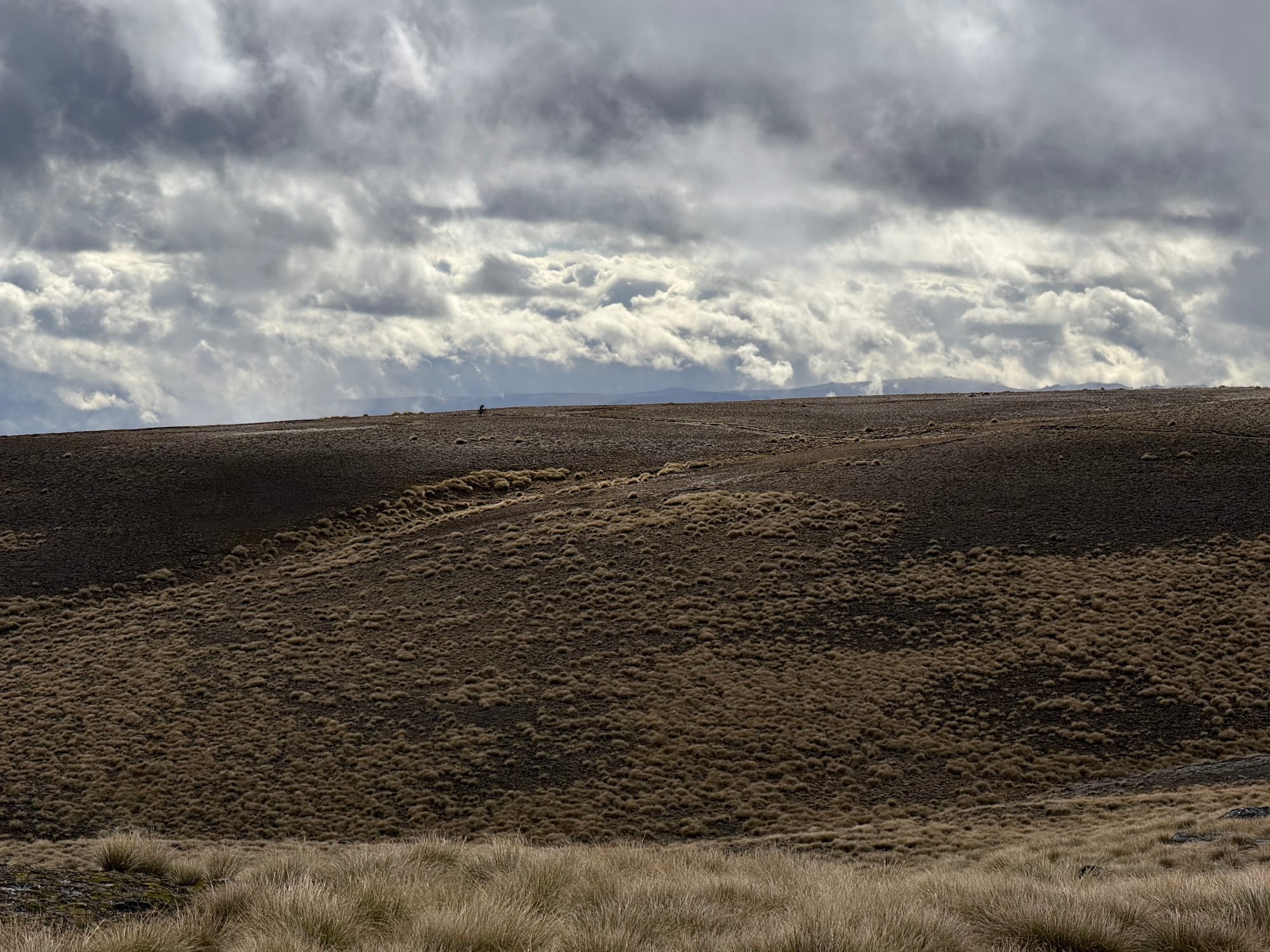
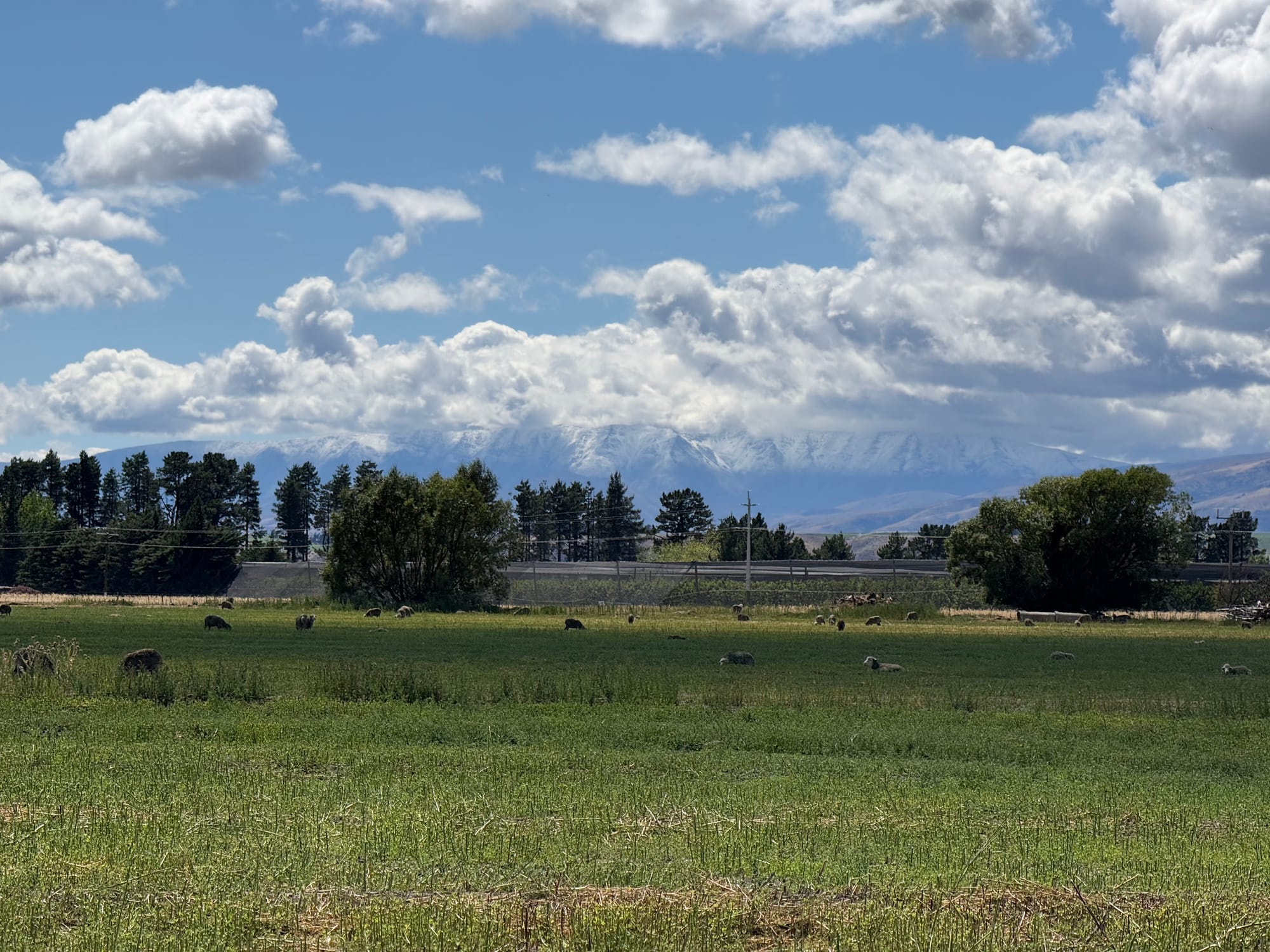
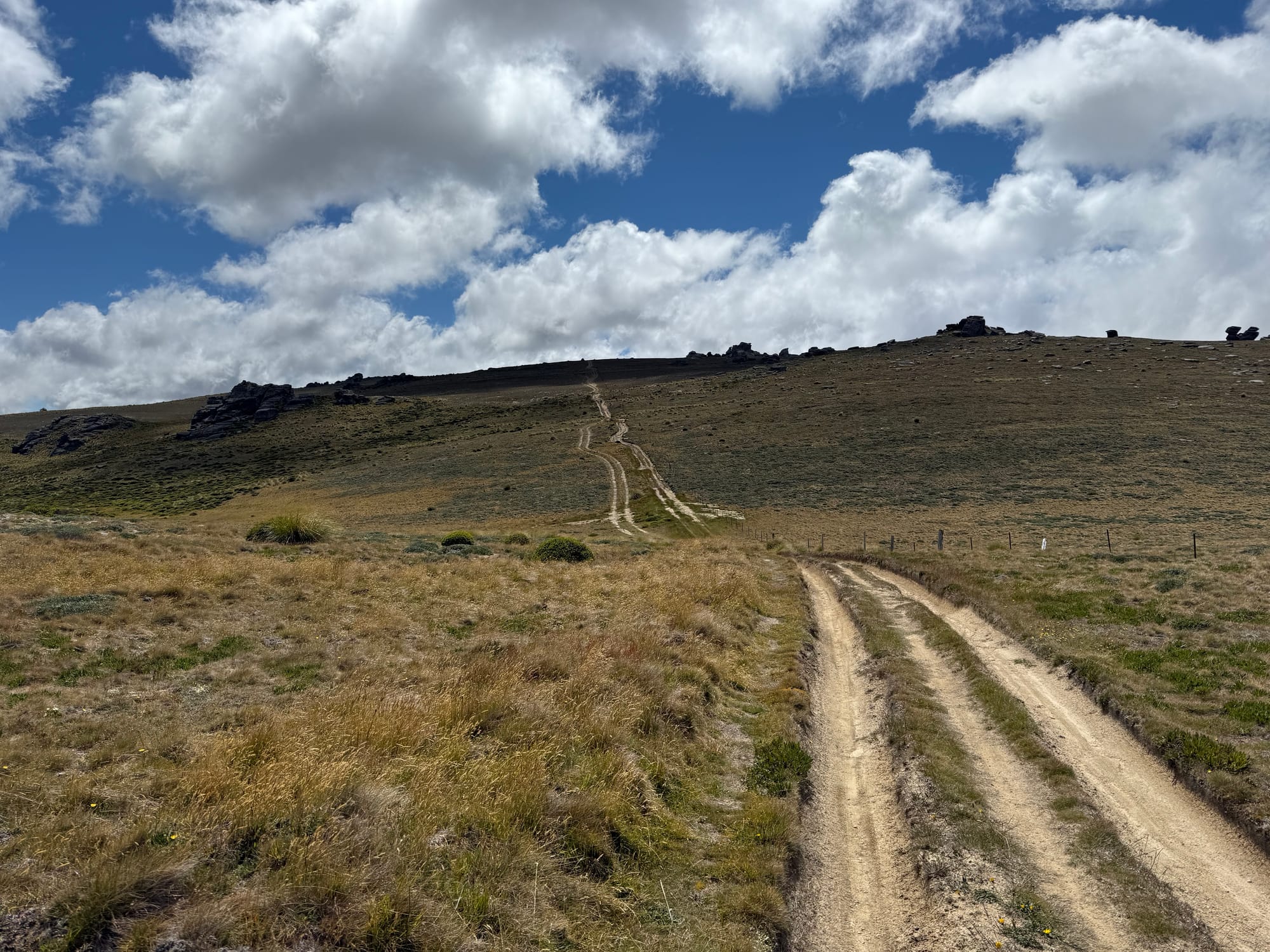
For 2025 the route was to be based on the 2019 one and on that basis nearly 200 signed up (about double the previous highest number). Two weeks out the GPX was released and it was a much more challenging route with a lot of ascent (18000m) and much of that slow, steep, hike a bike. I was pleased to get to do the Old Woman Range I had missed out on in 2023 but was also a bit concerned about the large numbers combined with the lack of reliable resupply for long sections.
I had never checked the forecast in the lead up to a GSB before but for some reason this time I did and it wasn't looking great. I expressed my concern to my companions travelling down from Christchurch that the perfect storm of high exposed tops in potentially bad weather, large numbers of (many less experienced) riders, and reduced resupply/accommodation options may cause some problems.
With this in mind I expected to camp most or all of the time and decided to carry three freeze dried meals from the start along with more warm clothing than usual. So my bike setup was my heaviest since perhaps my first brevet, where I didn't really know what I was doing.
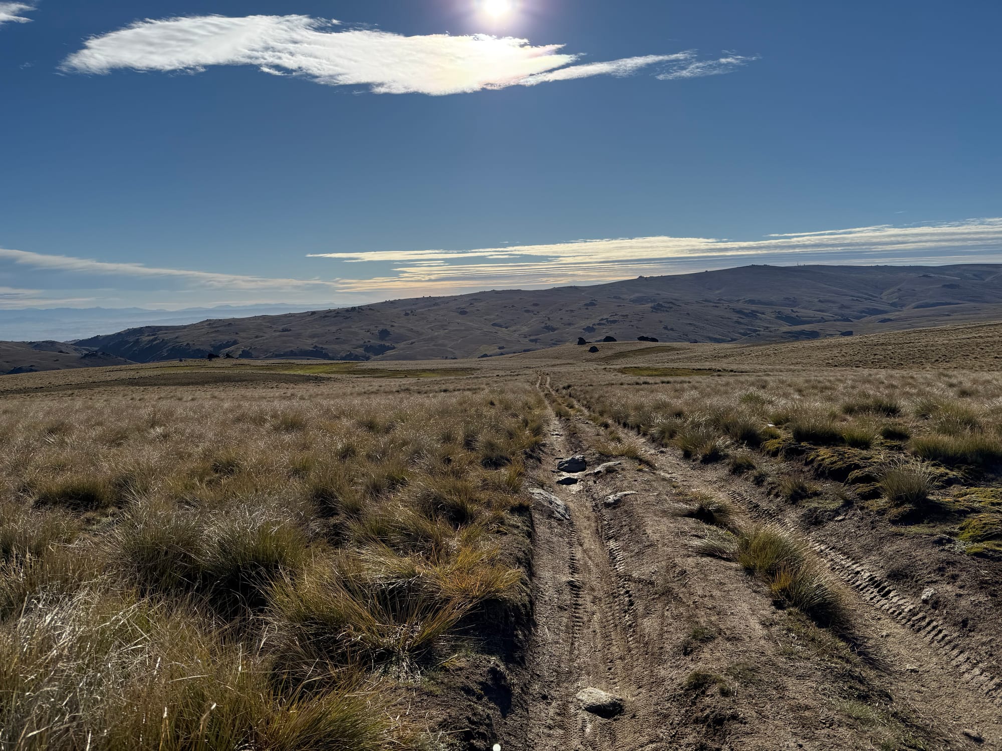
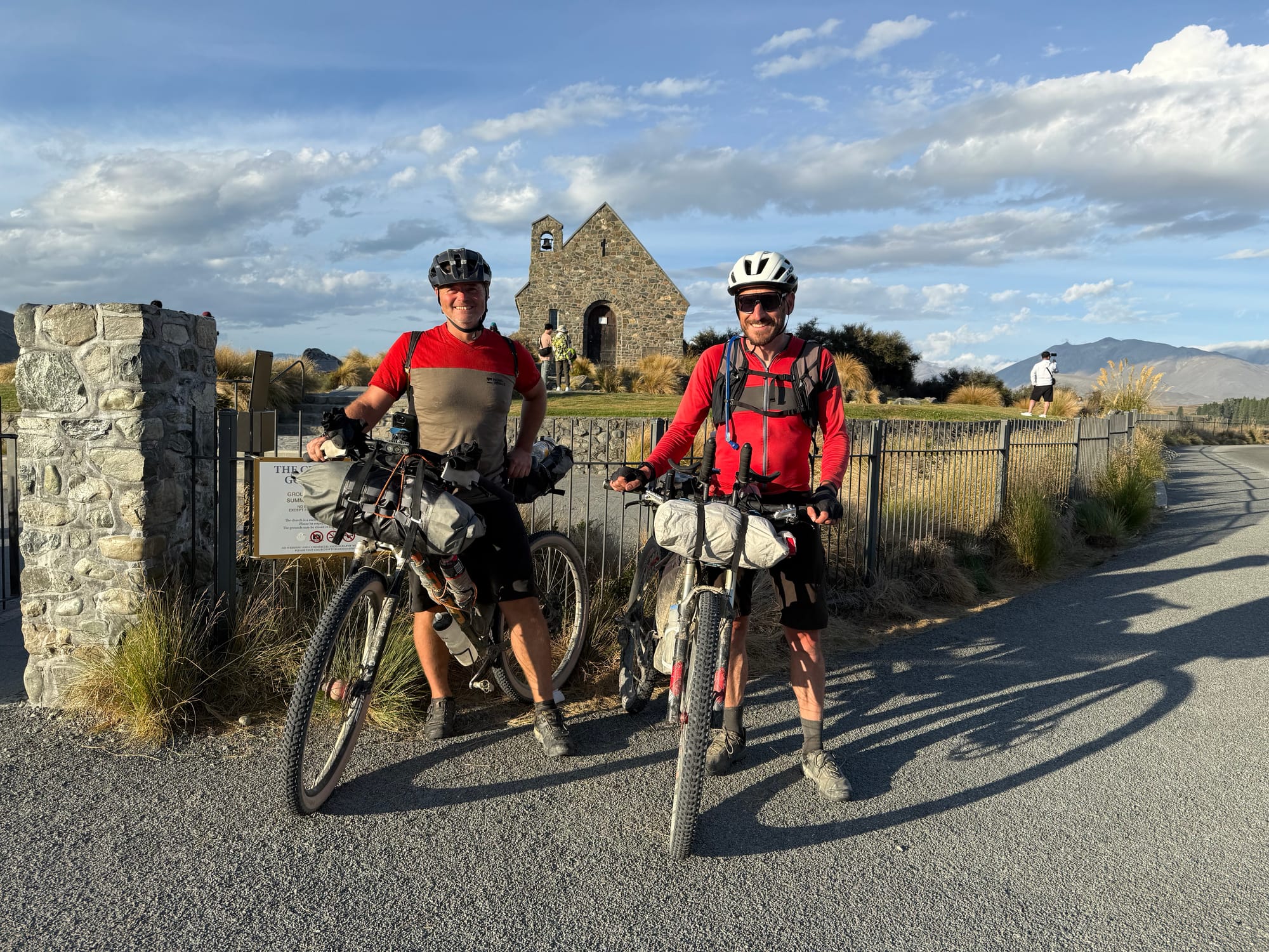
Day 1 - Tekapo to Oterehua
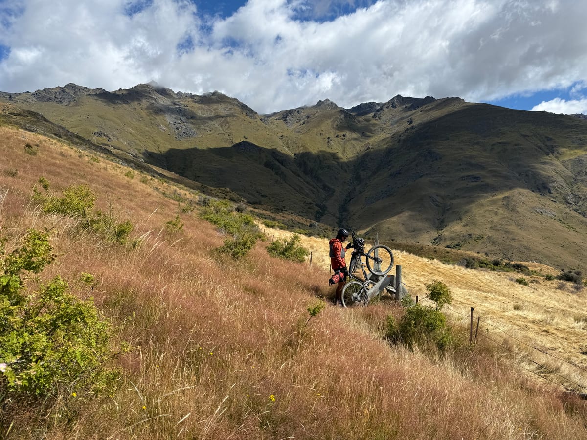
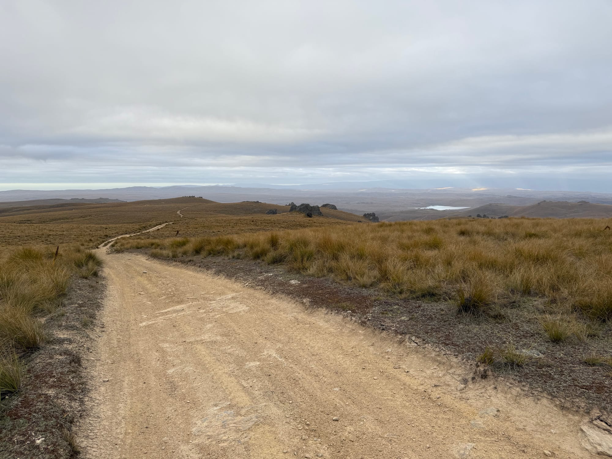
The grand depart was in two parts, the main one being after the annoying metal gates that would otherwise be pinch points. The GSB usually has a 9:30am grand depart but with the second stop it was practically 10am before we got away. To do a 200km+ day after that was always going to be a late night.
I wasn't sure who, if anyone, I was going to travel with. Scott, my usual companion on brevets, hadn't been able to train properly due to injury so was going to take it slower. Paul, who I struggled to keep up with at times on the Tuatara 1000 last year, wanted to take it easy. I got in the mix along the bumpy road and eventually settled in next to Daniel who I'd travelled with in a group of 3-4 for much of 2023 GSB. We had the same goal of doing this in six days and seemed to be moving at a similar pace.
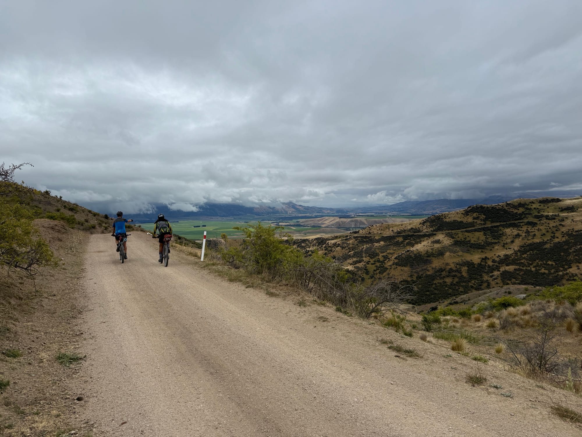
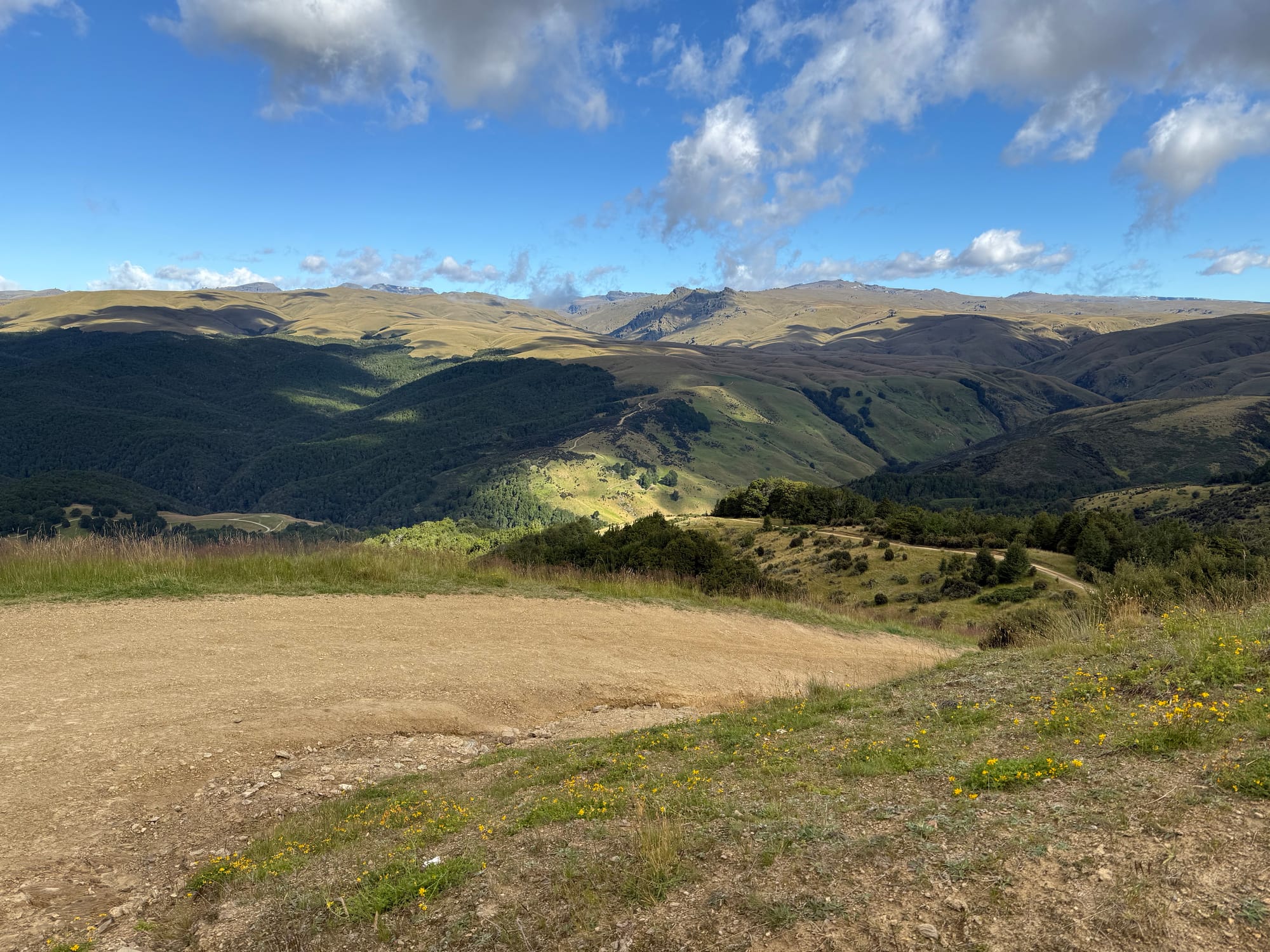
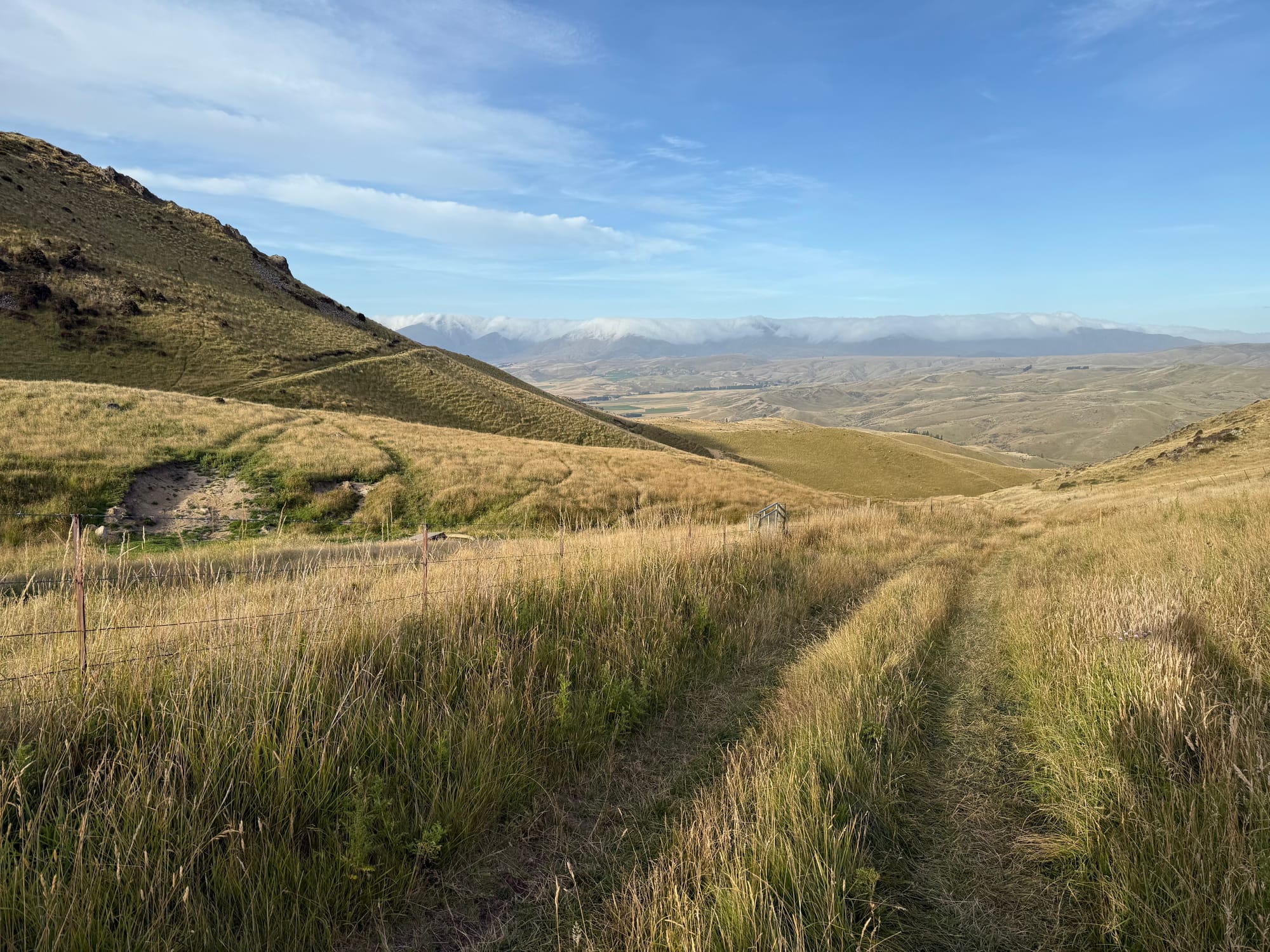
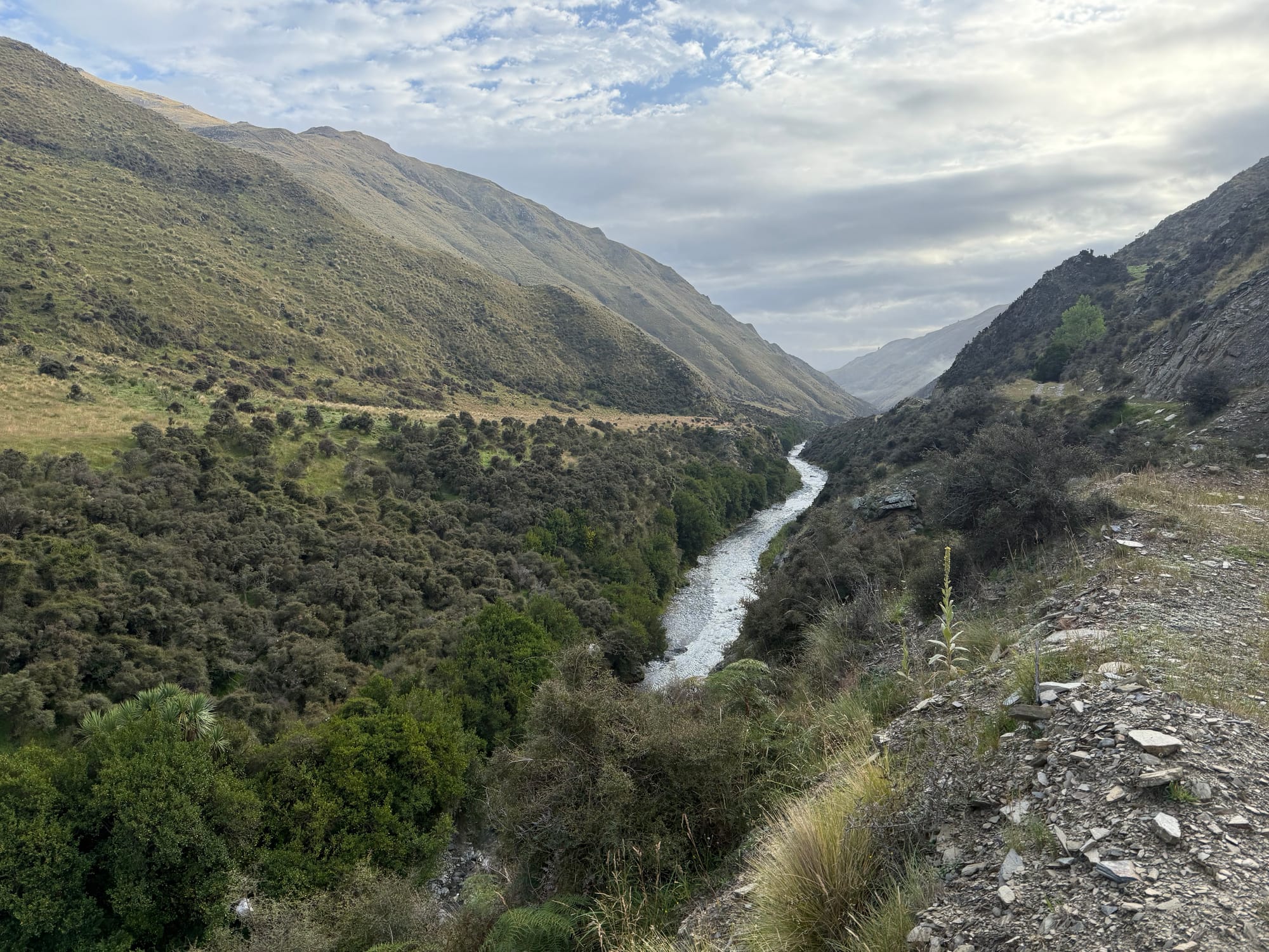
The ride down the rocky gravel road by the Tekapo River had plenty of space to chat to people as you rode along. This continued on into the Black Forest Station private land section. Eventually I ended up on my own nearing Benmore Dam and the A2O section on to Omarama.
It was somewhere along here I ate half of my bacon and egg pie (picked up from Fairlie Bakehouse early that morning) and soon after my legs woke up and I was coasting near 30km/hr along the smooth flat-ish "rail trail", passing quite a few people before reaching Omarama.
The Four Square in Omarama had prior warning per the influx and had done an amazing job setting up an area outside with camp seating, music, plenty of the food bike packers go for (especially chocolate milk), assisting on the electronic checkouts, and even a tap for water.
I had run out of water 10km prior to Omarama so accidentally drank a whole bottle of chocolate milk rather quickly. This upset my stomach for a couple hours and I was far from the only one! I also rushed the resupply and had to go back for more once I remembered the next open shops I'd hit were potentially the following afternoon.
While catching up to the others I met Rochelle and chatted with her for a while along the tarmac section towards Little Omarama Saddle. She had trouble keeping my pace on that section but during the brevet she was very efficient and not afraid of super early (1-2am) starts so finished half a day ahead of me; third female finisher.
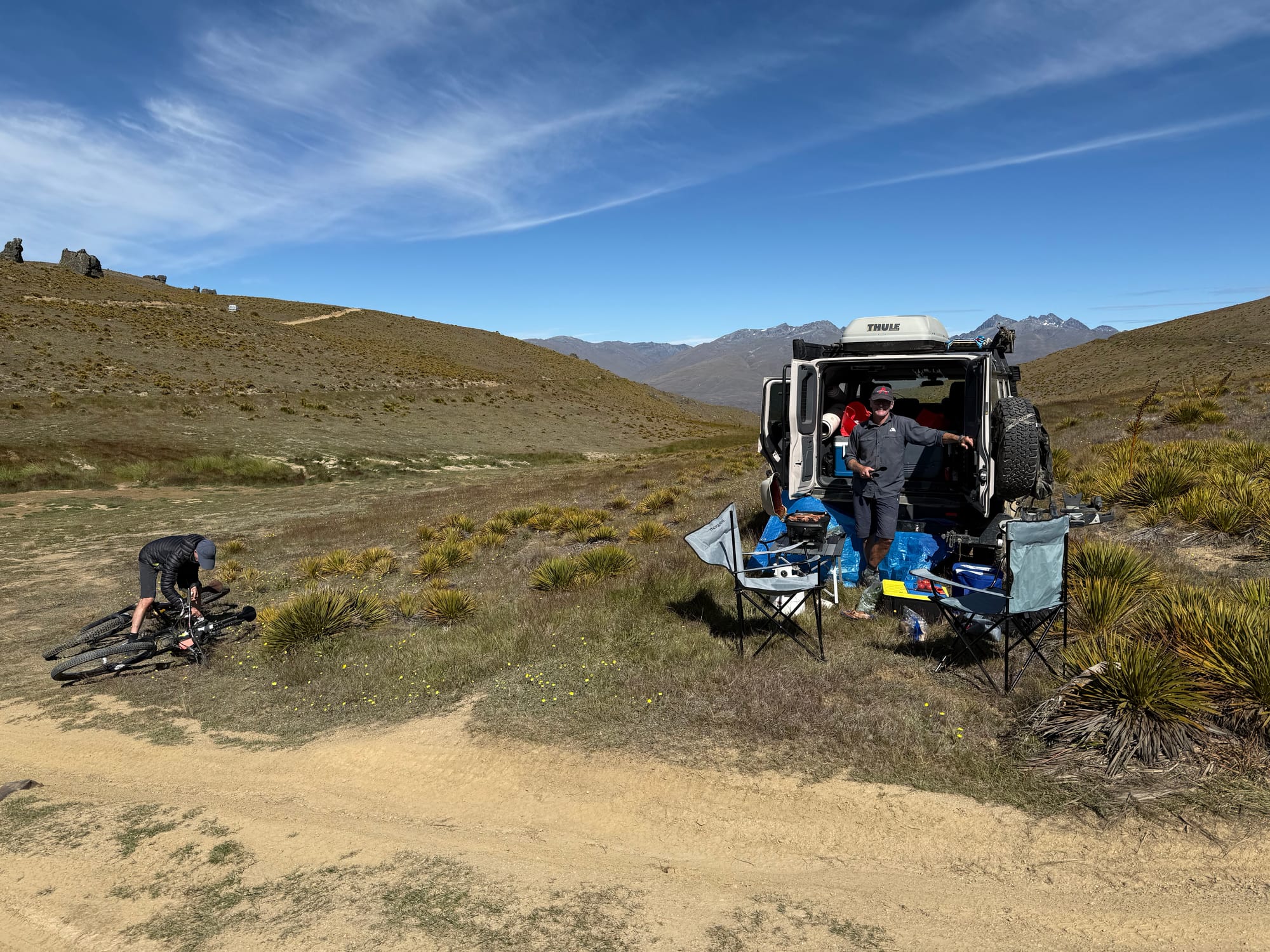
The bike push up Omarama Saddle was the first of many but this one I had done before. Off down the other side in plenty of daylight we still had a long way to go to Oterehua and Daniel got well ahead of me. It felt like a long time in the dark before I got to Crows Nest. We'd booked the campsite but on arrival, a pleasant surprise: there had been a group cancellation and we could have a bunk instead. After food and faffing we got to bed after 12:30am.
Day 1 stats: 200km 2156m 11hrs (moving) 14hrs (elapsed incl pushing)
Day 2: Oterehua to Luggate
Everyone got up 5am and downstairs were a group sleeping on the couches. They'd arrived 1am but got up then too. Riders dissipated away and I was soon riding with the group along the rail trail at a slower pace than I might have, while expecting Daniel to catch up. Drafting was officially allowed so it was kind of a little bunch ride and got to chat a bit before I decide to move on and catch Daniel at Omakau.
Several others decided to wait 30 minutes for the Omakau shops to open at 8am but Daniel and I were both keen to carry on over Thomson Gorge. Big ambitions of getting to Clyde today with the unknown of the Pisa Range via the steep direction (a major part of the late route change).
I was keen to see Thomson Gorge as I'd ridden it in the dark in GSB21 and with weather forecast to come in I got ahead of Daniel rushing to the top. There were a few clouds about but still good view. Not spectacular though and not as many gates on the way down as I remembered. I waited for Daniel at the top gate and a few others joined our descending group including Karl and we carried on along the flat towards Luggate.
Just before reaching Luggate the rain started and it was quite heavy and persistent. We briefly met Rochelle before she headed off (she and others had got away a tad earlier in the morning). We (Daniel, Karl and I) took refuge in the pub and got some food and sorted ourselves out. I was openly wondering how the weather would be up on Pisa. Checking wind direction and speed. It was supposed to be southerly which of course would be stronger up high. Checking Maprogress there were dots still moving along up there we decided to push on anyway.
At the Queensberry turn off, where the climb up Pisa Range began, it was still raining heavily and cyclists started appearing from up the hill, having retreated. All looked cold and wet, some shivering, and none had got more than 1000m up (the top is 1950m). Atrocious and dangerous conditions apparently. We had a discussion and Karl decided that, since the forecast for the next day that he had said it would be worse, he decided to carry on to Cromwell along the road. The other cyclists generally headed towards Cromwell as well, often to their pre-booked accommodation. I guess that is one way of dealing with small towns en-route if you want a roof you have to book ahead which is a shame in a brevet like the GSB.
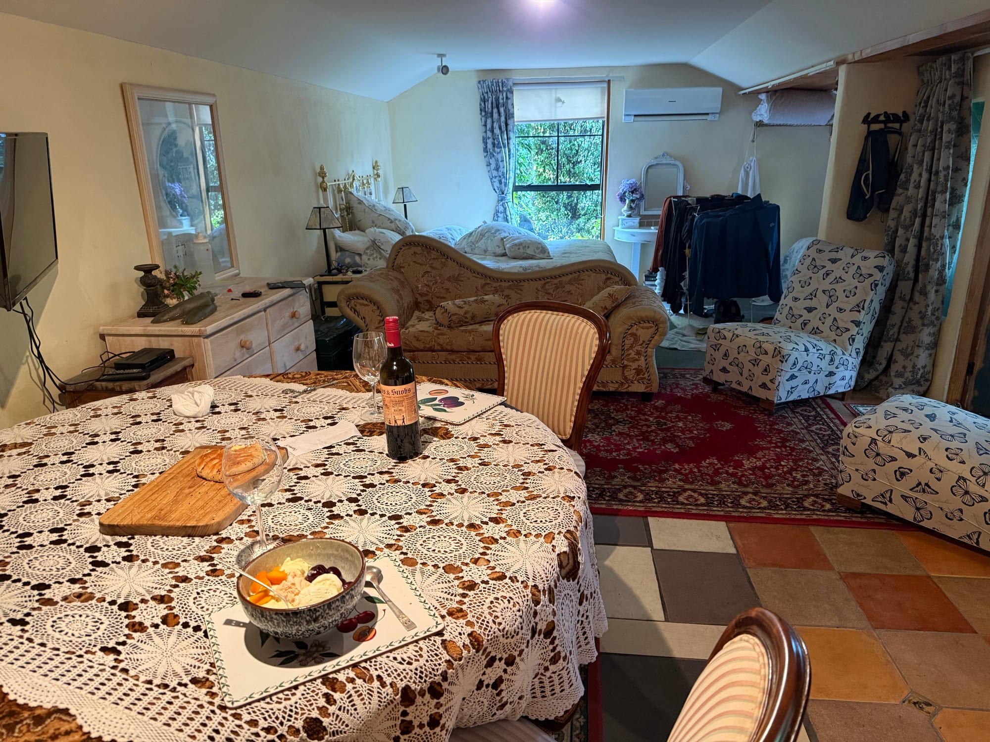
Daniel and I had seen a more optimistic forecast and, even we hadn't, we wanted to take the chance that it would be good the next day so headed back towards Luggate. We didn't want to camp in the rain and, with not much accommodation around Luggate, were discussing options of hitching to Wanaka and back but Daniel spotted a B&B sign without a "No" against the "Vacancy". He enquired and apparently the No on our side had dropped off and she wasn't actually running it currently but Daniel talked her into having us stay. So we got a nice big room with antique furniture and they even gave us dinner, dessert, and a bottle of wine (which we somehow didn't touch).
A 2-3pm finish, we had an afternoon nap. Waking up the rain had cleared and another bike packer knocked on the door, also staying there. Mike had got 400m from the top and turned back but was keen to try again next day. So we got the full lowdown on how bad conditions were up there. Daniel suggested we have an early night and start so we agreed 4am morning start (in hindsight we could have done earlier).
Day 2 stats: 116km 1270m 6:30hrs (moving) 8:45 (elapsed)
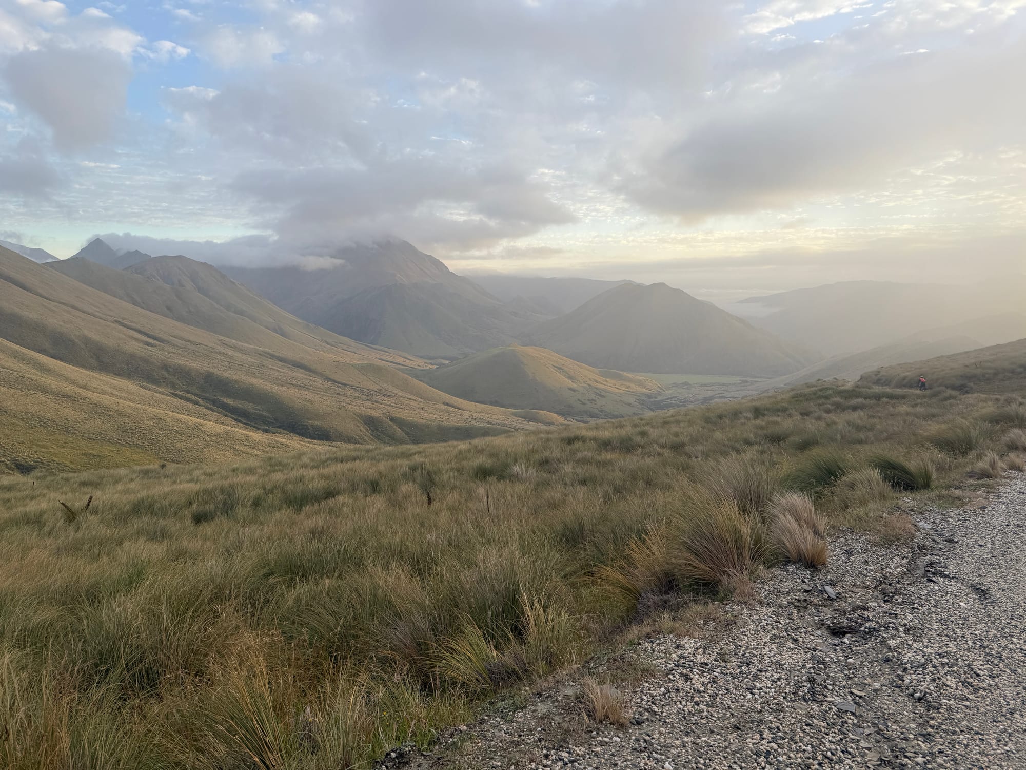
Day 3: Luggate to Old Woman Range
The Pisa Range was a lot of bike pushing, as expected from our memory of descending it in GSB23. We passed a few tents lower down, the highest of which was Scott's in a very picturesque spot.
We had great views though, low wind (until the very top) and one or two mild snow flurries. I reckon 80% of the time ascending was hike a bike although a lot less than that of the distance.
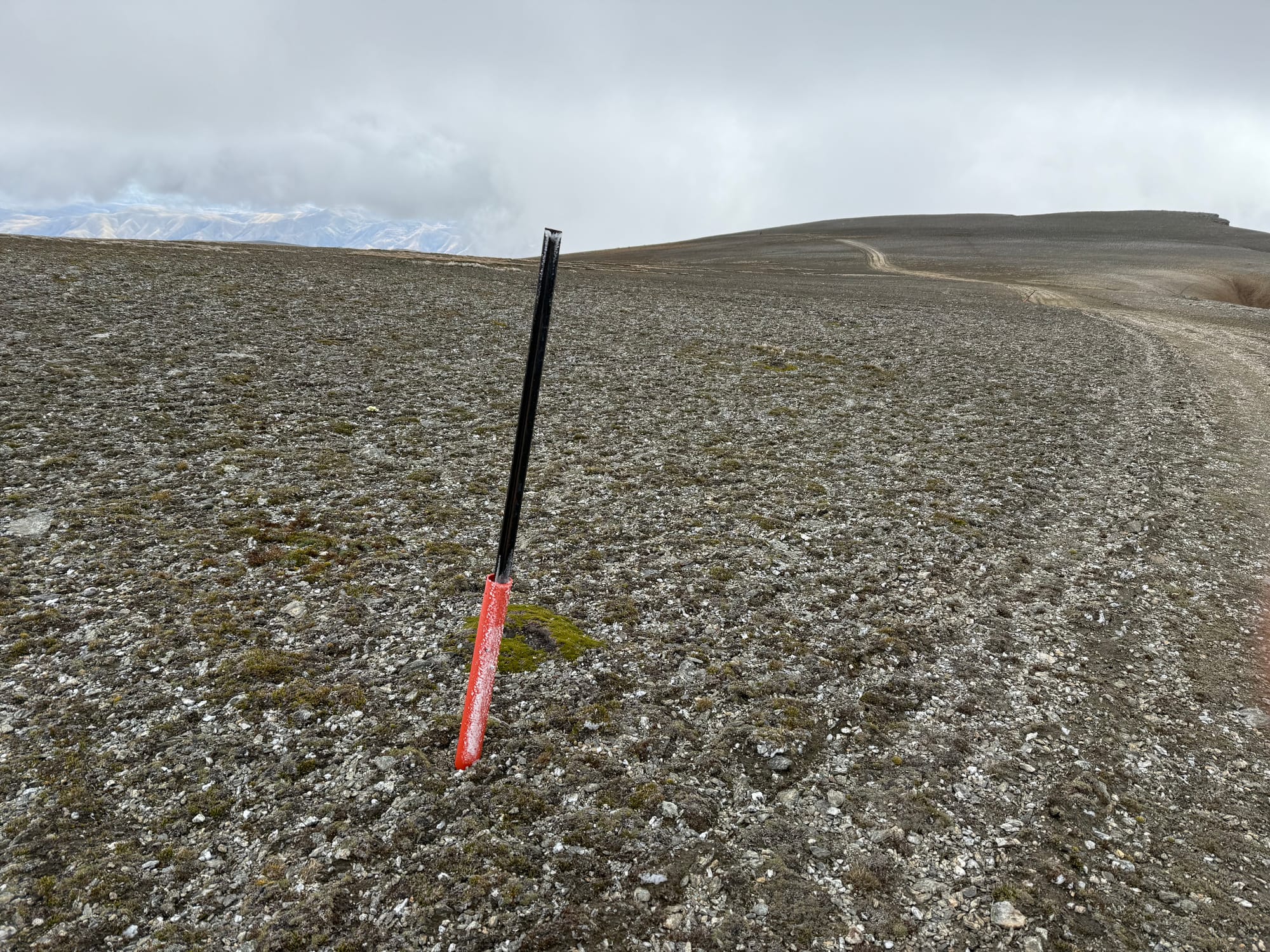
We reached the 1900m mark and the cold southerly hit us. It wasn't too strong though. I was comfortable in my light down jacket covered by my rain jacket and three quarter rain pants with single layer polypro gloves. I had a lot more gear to call on if conditions were worse. However I did notice we were at that 1900-2000m exposed level for the better part of an hour before we could descend. That would be committing in bad conditions.

The descent was immense. I knew this was coming, among others, so in prepping my bike I had replaced my worn out brake rotors with higher end ones and put new pads on (plus carried spares). Even so it was hard to hold the bike back and it was sketchy now and then. I heard later someone crashed on this descent and had to pull out.
We got to the bottom to warmth and sun and were changing out of our warmer clothes when a farmer came through to shut the gate and told us we were slow! I pointed out there were a lot more to come through yet!
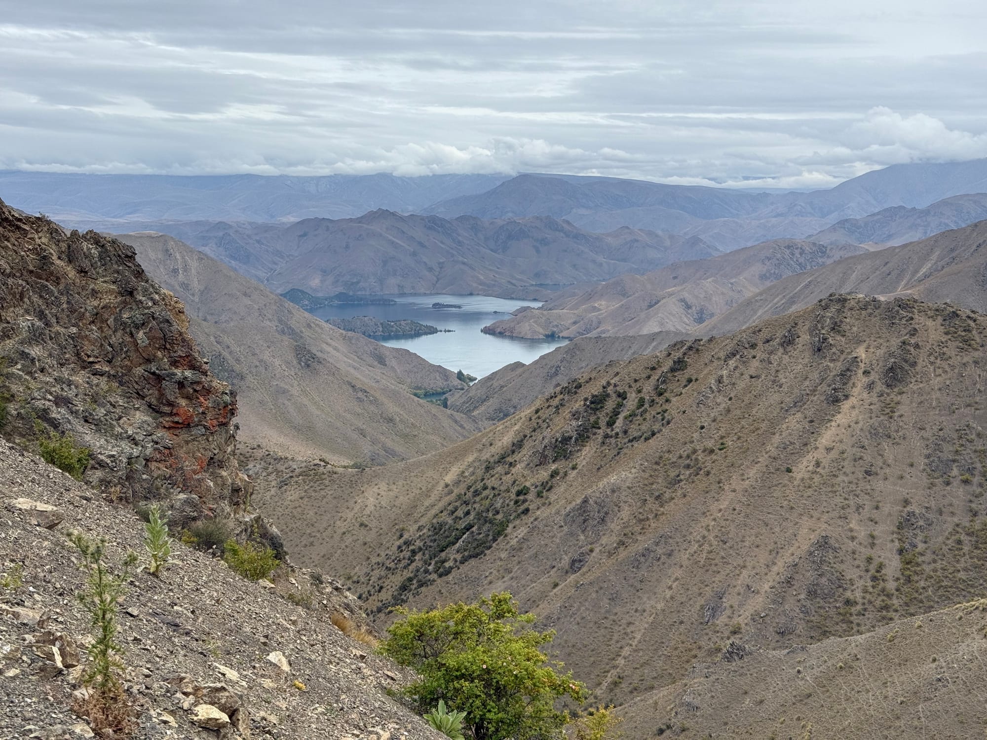
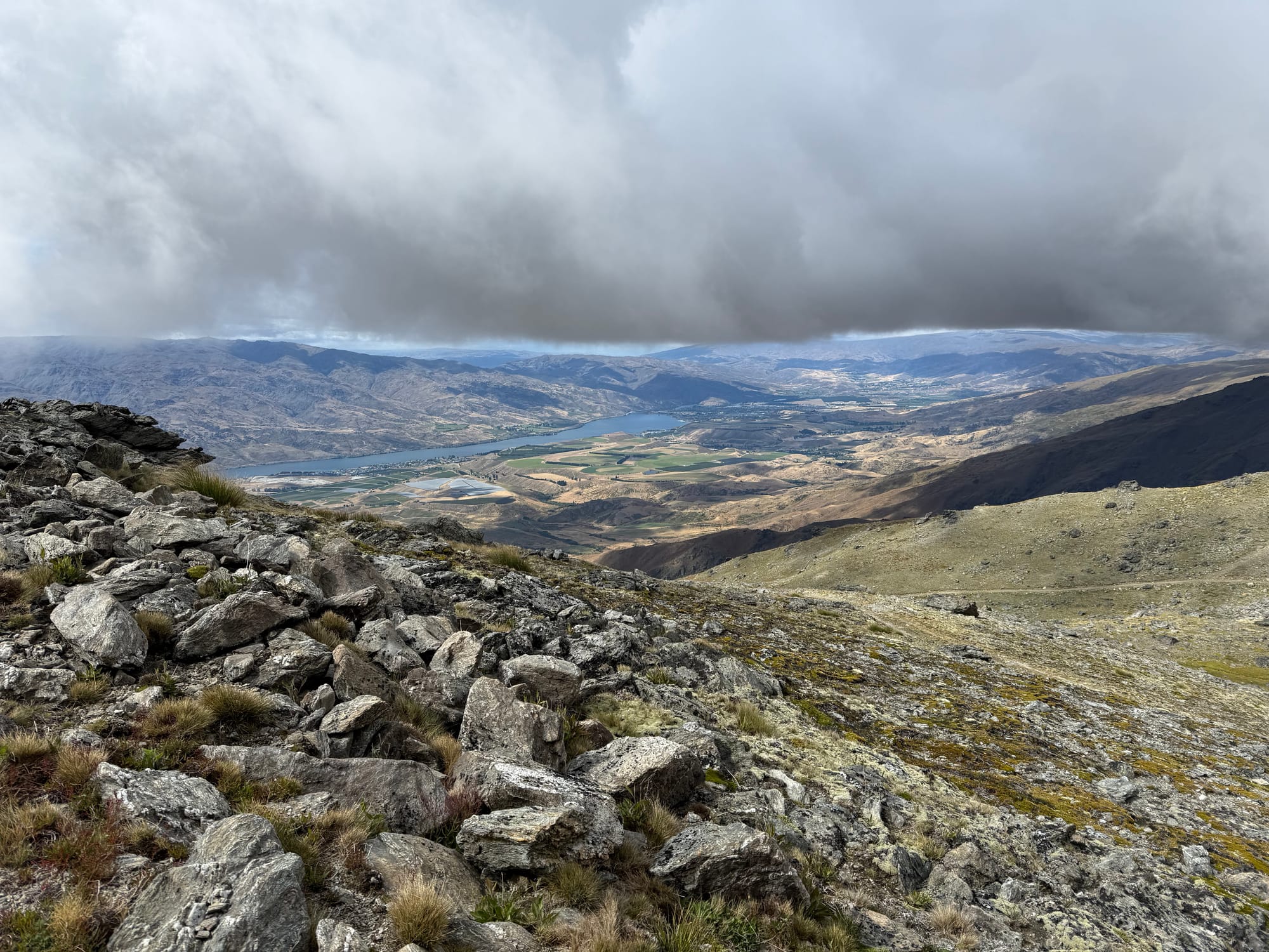
We arrived in Cromwell about 9 hours after leaving Luggate. So if we had got through the previous day we would not have made Clyde without riding well into the night.
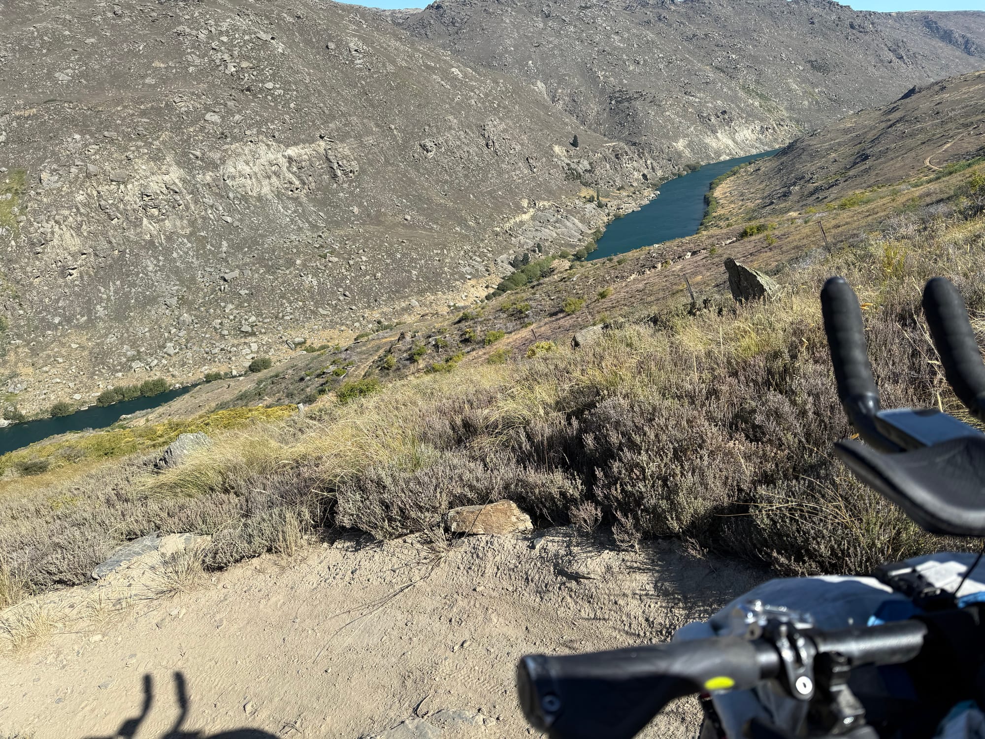
A slightly longer than usual resupply in Cromwell where we got some more freeze dried meals for the more remote days ahead and then onto the Dunstan trail. Daniel and I just zoned out and cruised our way through to Clyde. I did meet a couple on a tandem MTB who recognised me, it turned out was Shane of Mapprogress doing the Hawksburn/Dunstan trail loop with his partner.
We got to Clyde and I was surprised how good the Night & Day there was (for the likes of us anyway). We weren't sure whether to push on or do another early start. In the end we decided on the former as still feeling strong. I called in very briefly on my aunt in Clyde for a glass of water (tradition from GSB21) and we carried on.
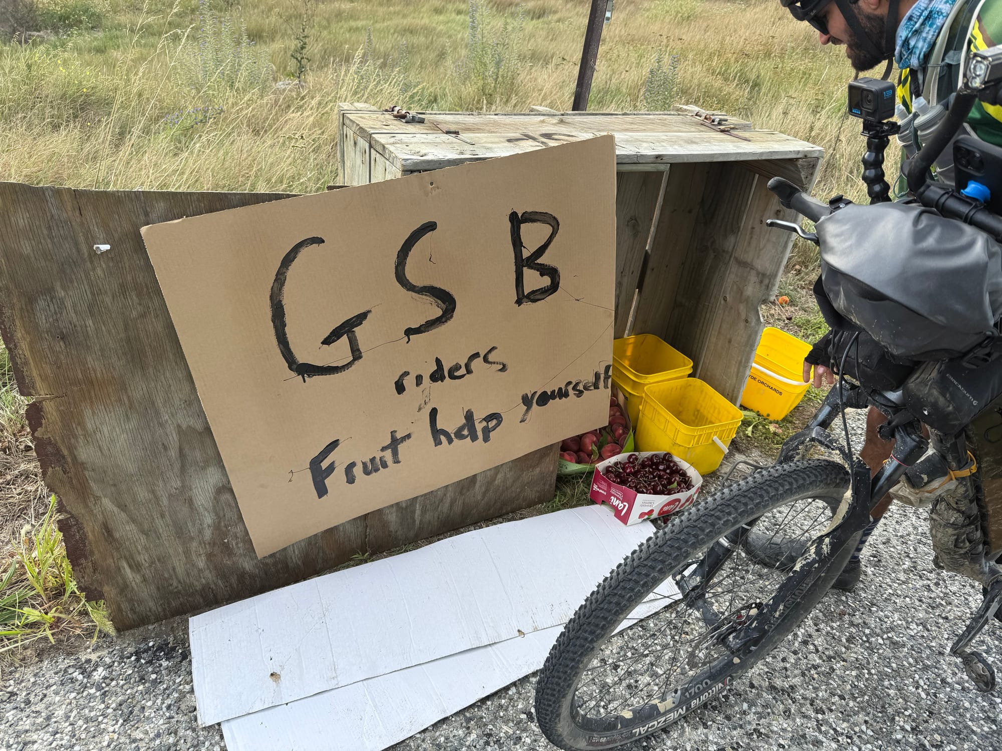
The free summer fruit on the next section was one of my favourite trail angels so far. I ate quite a bit on the spot and squirrelled away a bit more.
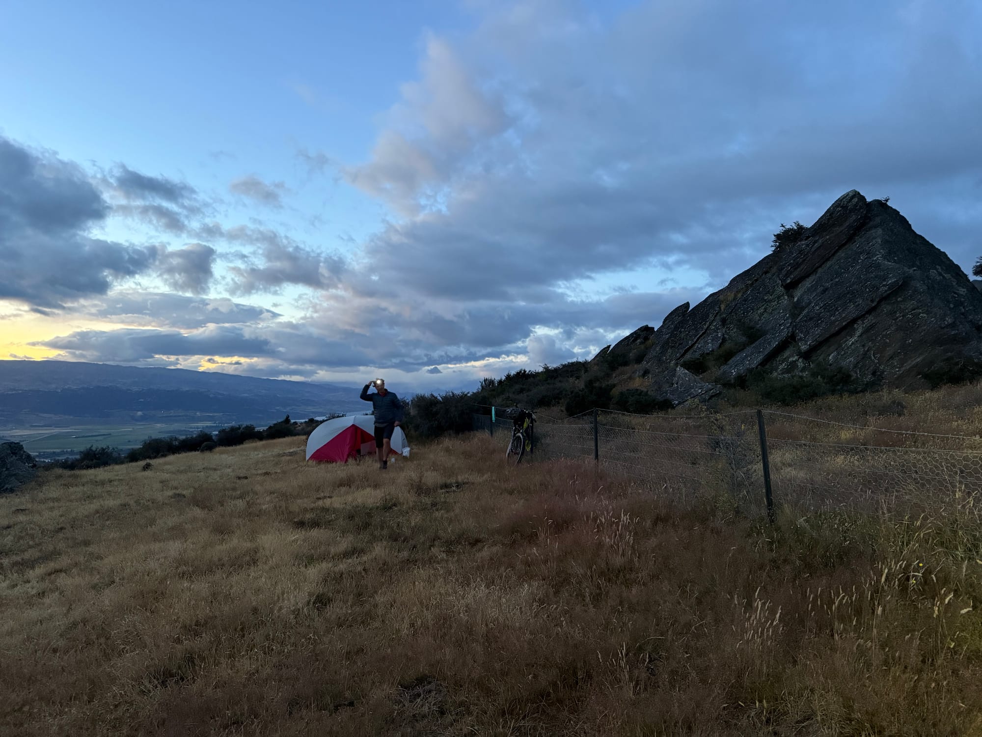
We weren't sure how far we would head up the Old Woman Range but we had a great view if not so great camping spot (for me), with a bit of a slope, but it did the job.
NOTE: stats are wrong, especially moving vs elapsed times, because my speed sensor battery was flat and my Garmin would think I was not moving when at walking pace
Day 3 stats: 125km, 2980m 9:15hrs (moving not including pushing) 8:45 (elapsed including pushing)
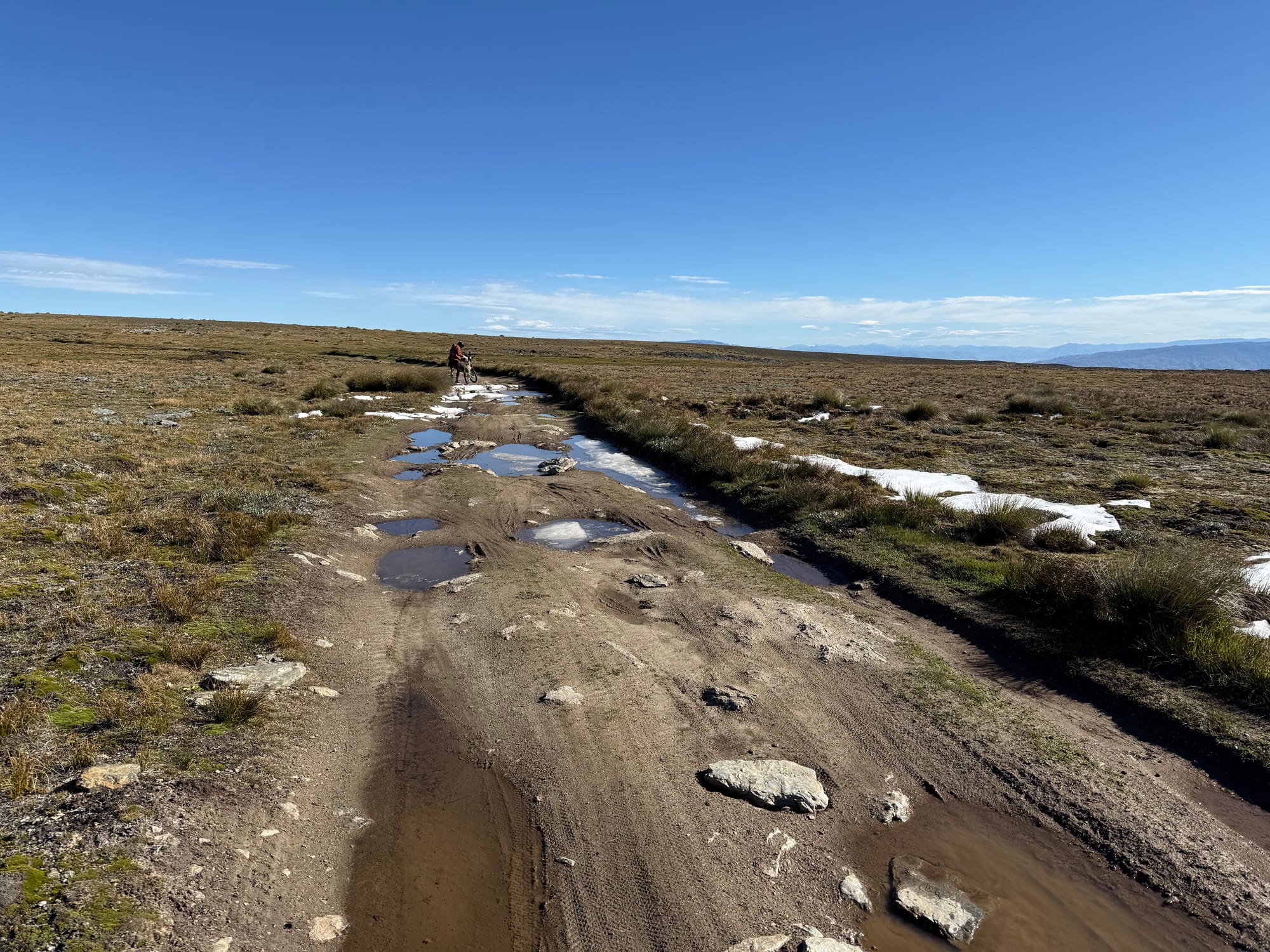
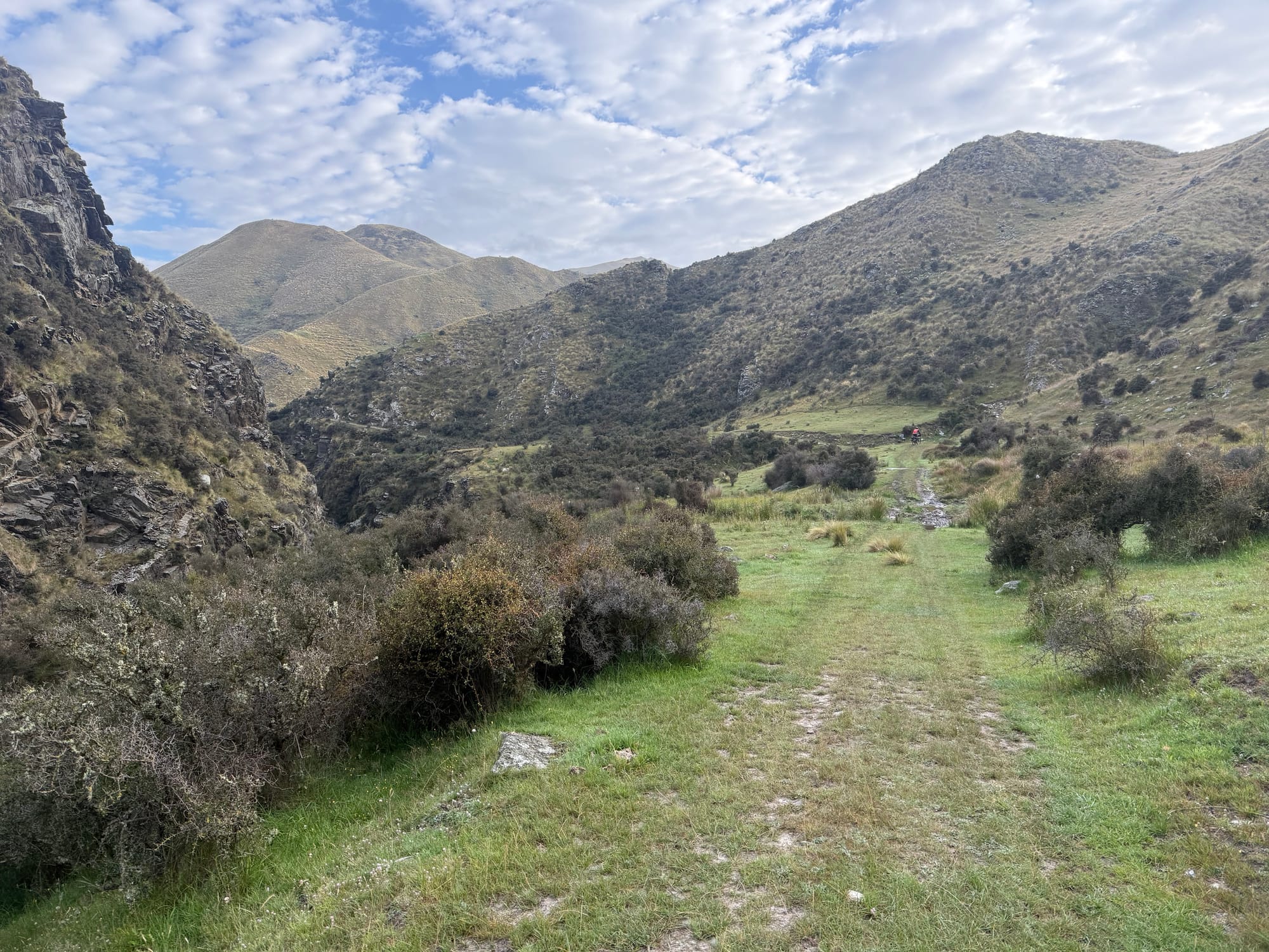
Day 4: Old Woman to Waikaia
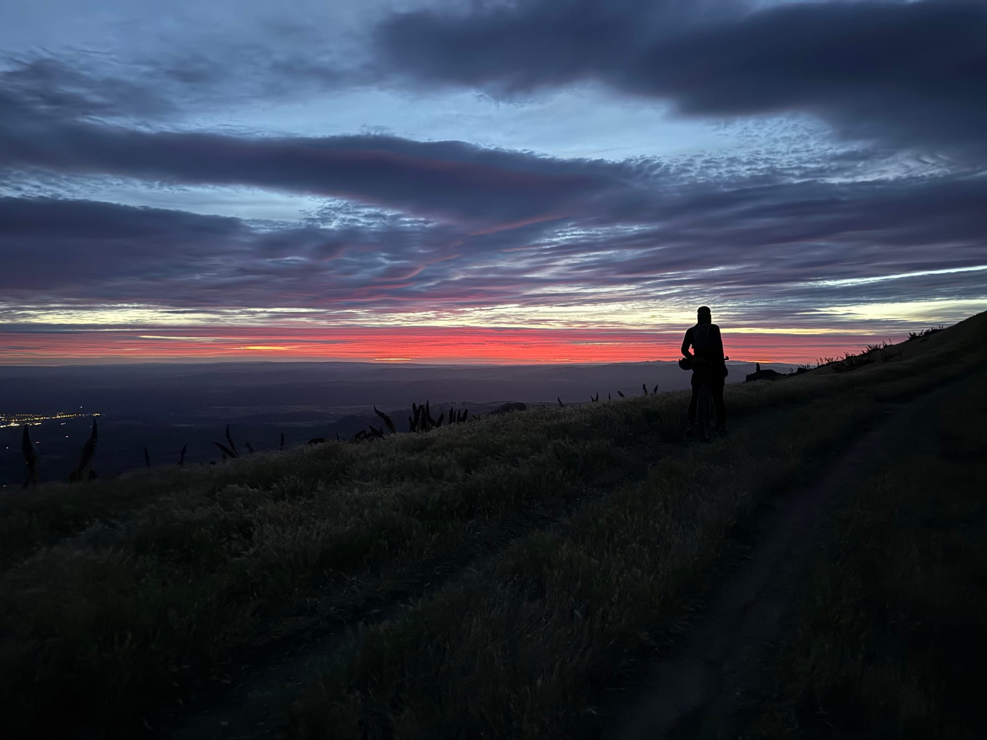
Setting off at 5am we got to look back on a sunrise. We made faster progress than I expected as I'd been led to believe there was a lot of hike a bike up here. I reckon maybe 30% of the time on the Old Woman Range was pushing.
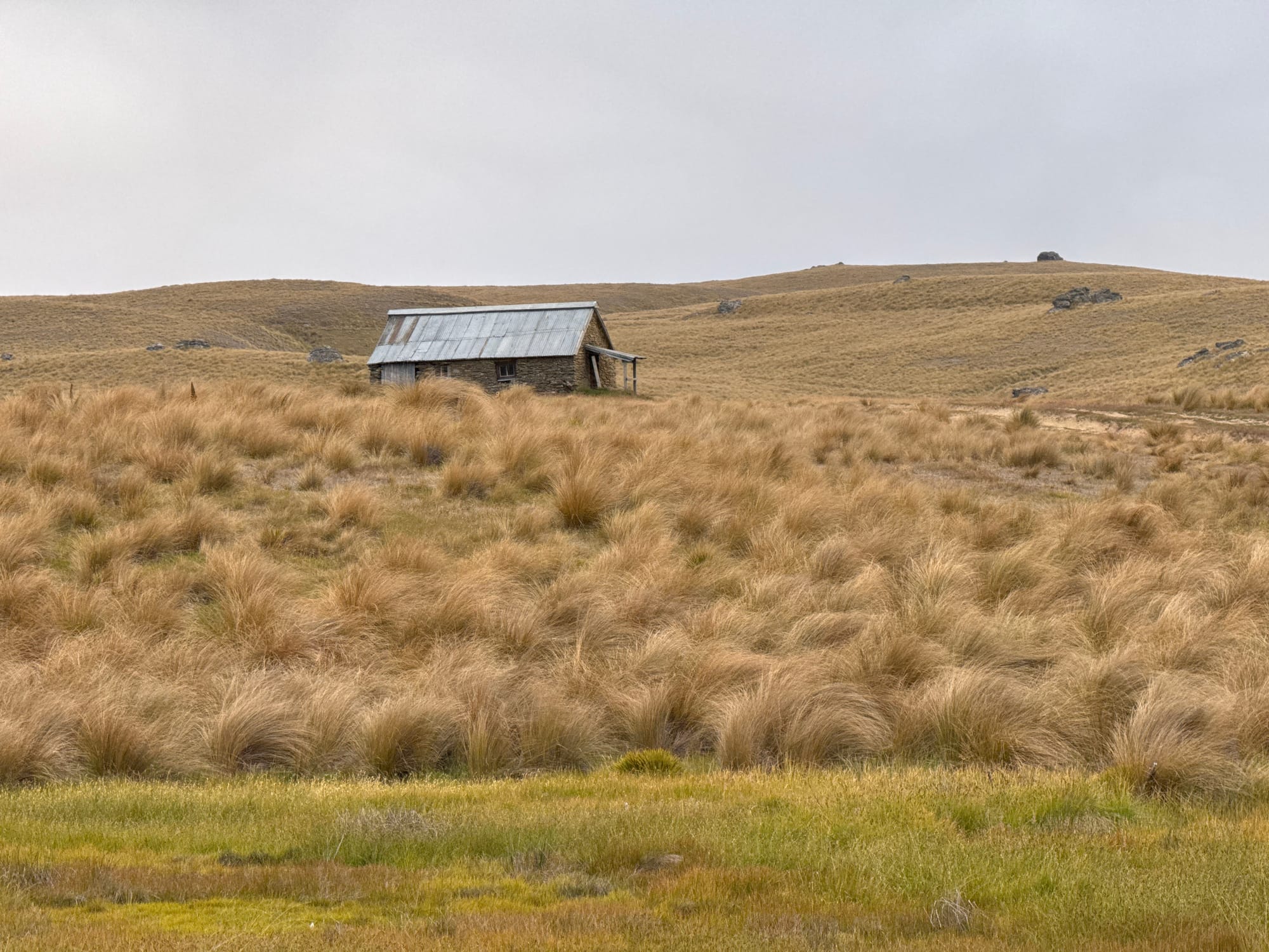
Before long we came upon a green hut that wasn't on the map and a trio of riders getting ready to go. It was around 8am so the others who'd stayed had long gone. I had some interesting conversations finding out about how the GSB got to be run like it is now.
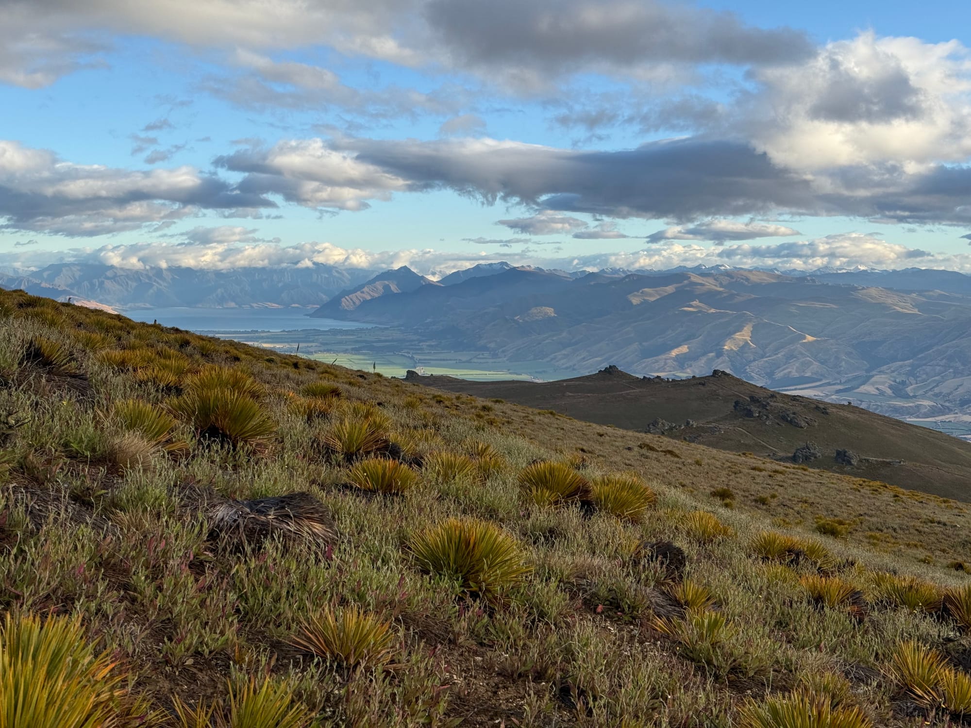
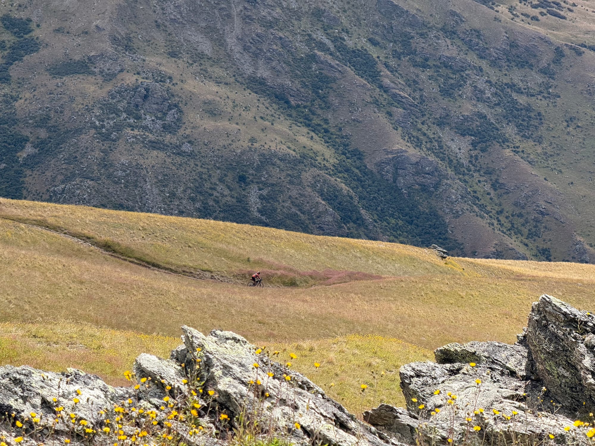
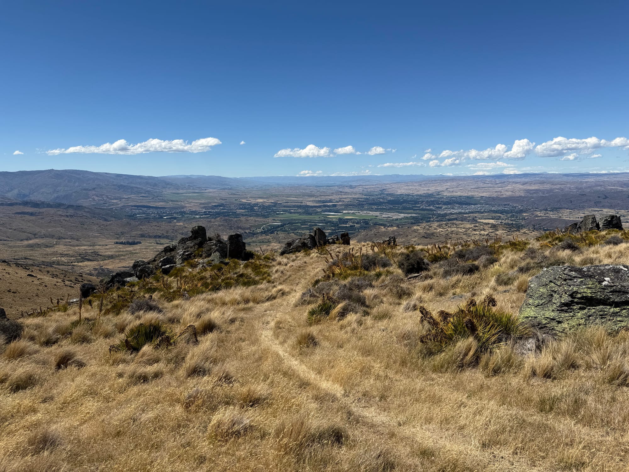
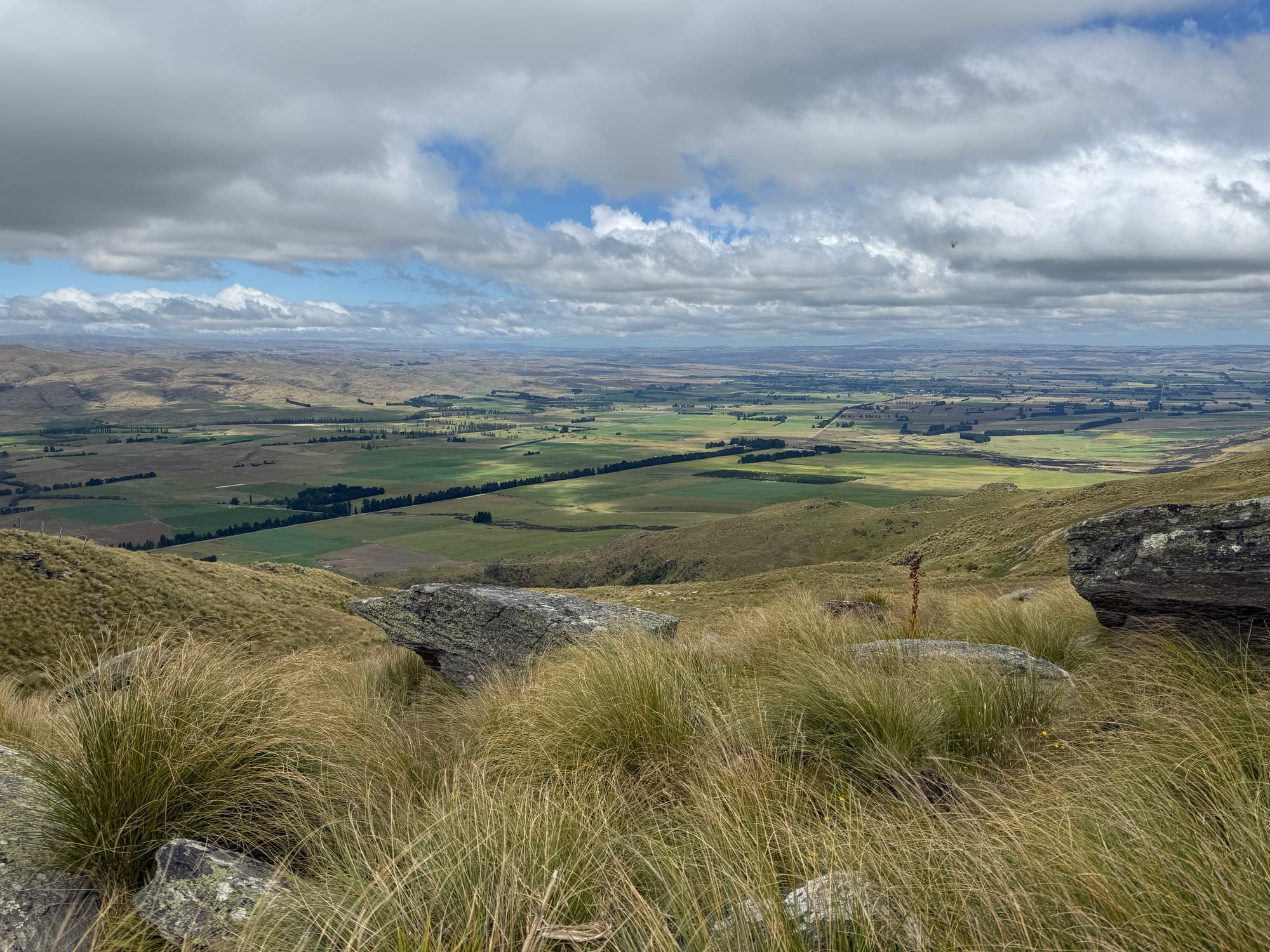
The next part was very scenic and varied. In general the Old Woman Range was one of the highlights of the GSB for me. It was clear and we could see some major mountains to the west and north such at Aoraki, Aspiring and even the tippy top of Earnslaw, at least according to Daniel who lives nearby.
We kept meeting these groups of four riders coming the other way doing the Magnificent, an adventure race.
After an extended period of flattish table top the descent towards Duffers Saddle started and it was fun and fast, taking some concentration to weave the ruts. Daniel was ahead of me and I saw him talking to people by a vehicle, I presumed part of that event. It turned out it was Dan and Russel setting up their bacon buttie trail angel and we were the first "customers".
A screaming descent down into the Lower Nevis valley, only held up by a vehicle and then a change out of our warmer clothes for the lower altitudes.
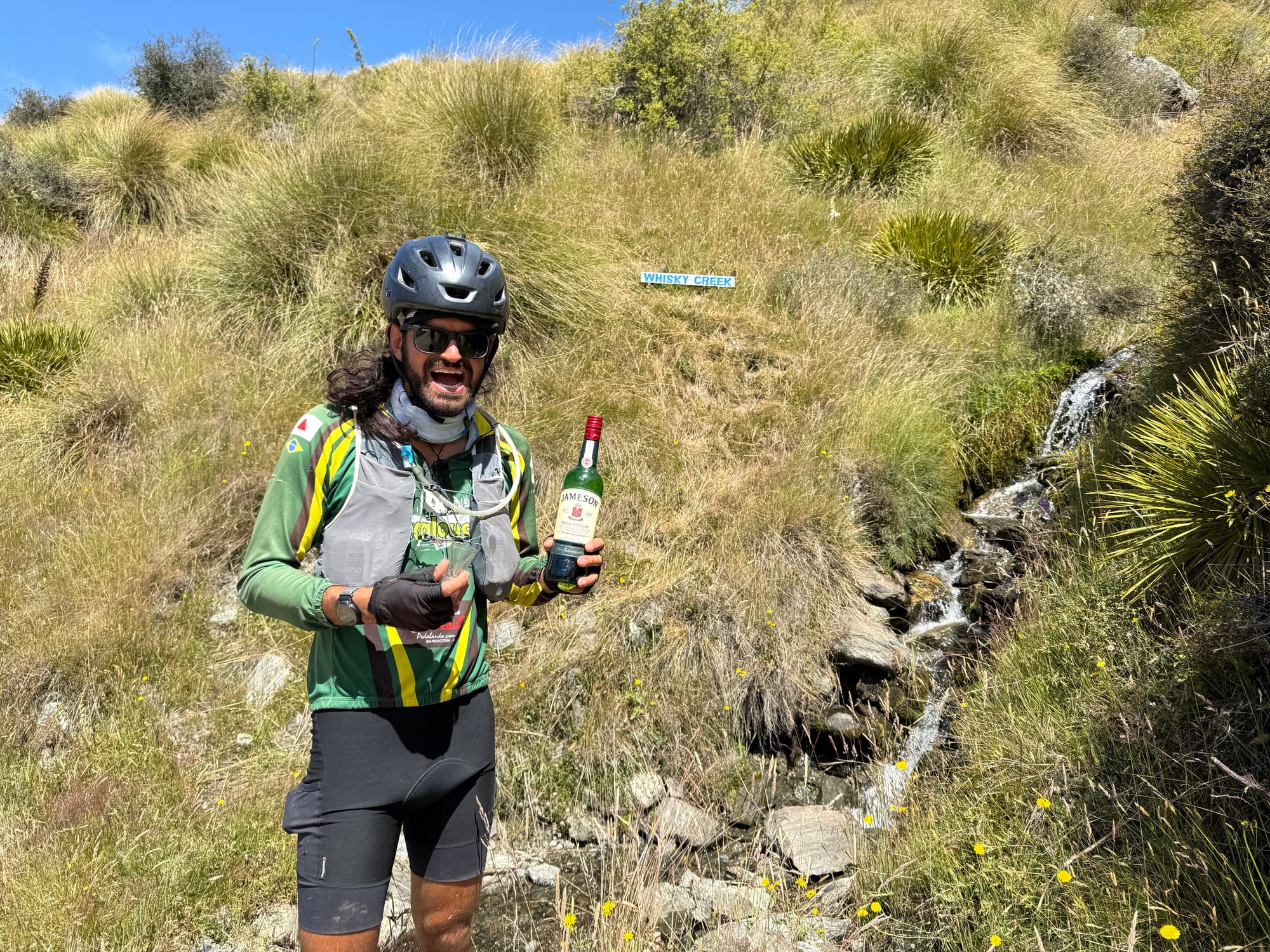
We stopped at Whiskey creek where Daniel knew where the bottle was hidden. My first taste of warm whiskey and it was actually alright. Also a good place to fill up on water.
The rest of the Nevis passed by relatively quickly. We had a light tail wind and very little traffic as a week day. We were keen to get to Garston before the mobile cafe closed at 4pm. As it turned out we were well within time. Daniel rang and booked a motel in Waikaia as rain in forecast plus we'd struggle to go further.
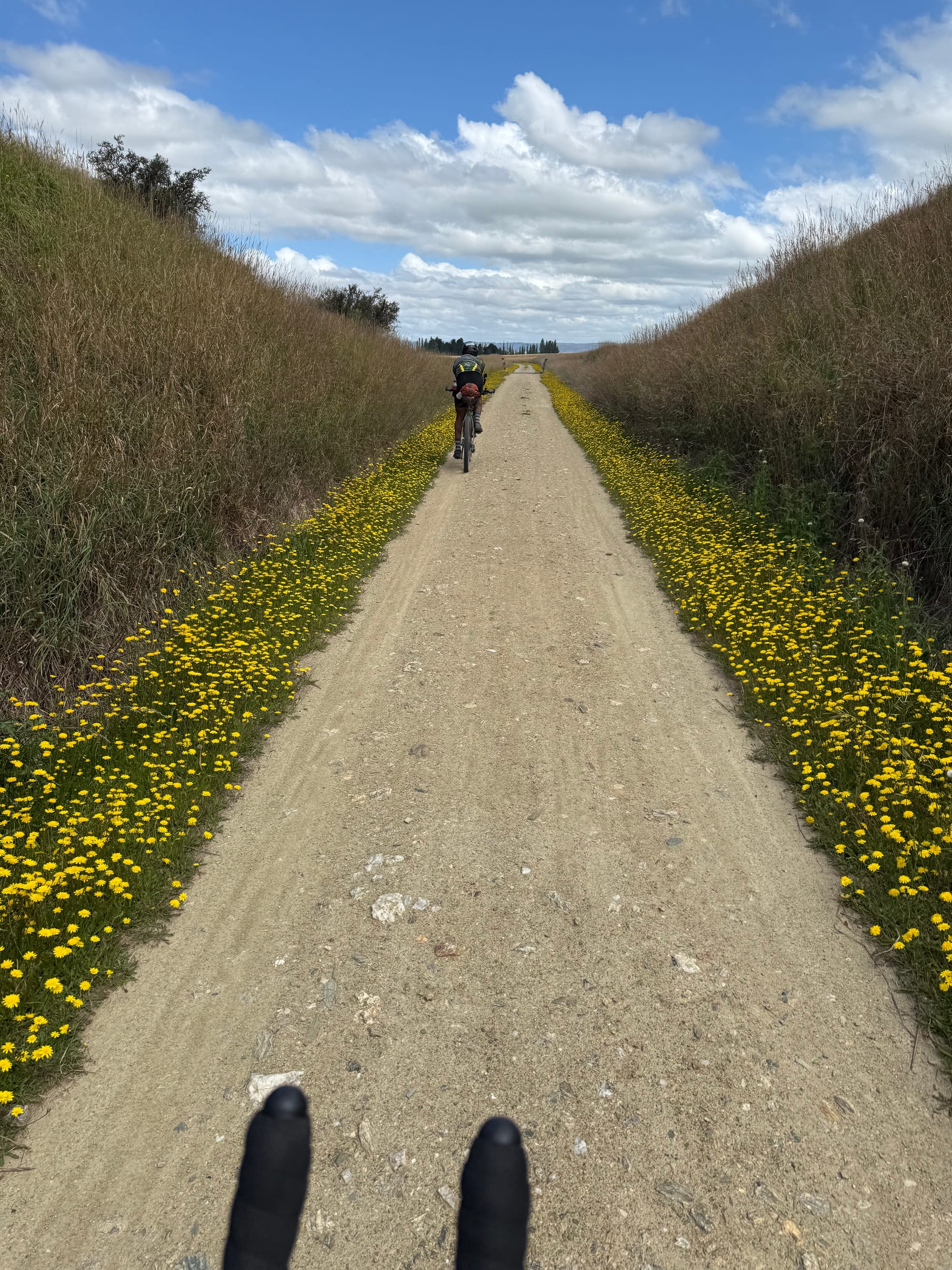
Then onto the aero bars on the rail trail in another tail wind (at least until Athol)
A quick resupply at Lumsden during which the rain arrived. It was heavy. But fortunately stopped before we got going and never came back.
The remaining section to Waikaia was fairly uneventful. We got in around 9:45. I couldn't eat tonight's particular flavour of freeze dried meal (a first for me).
Day 4 stats: 188km 2400m 12:45 (moving unless pushing) 16:30 (elapsed incl pushing)
Day 5: Waikaia to near Poolburn Dam
I'd argued the night before for a slightly later start as struggling with the short nights. So 6am it was. Meanwhile the other bikers at the same motel (who had got there earlier than us) left about 2am.
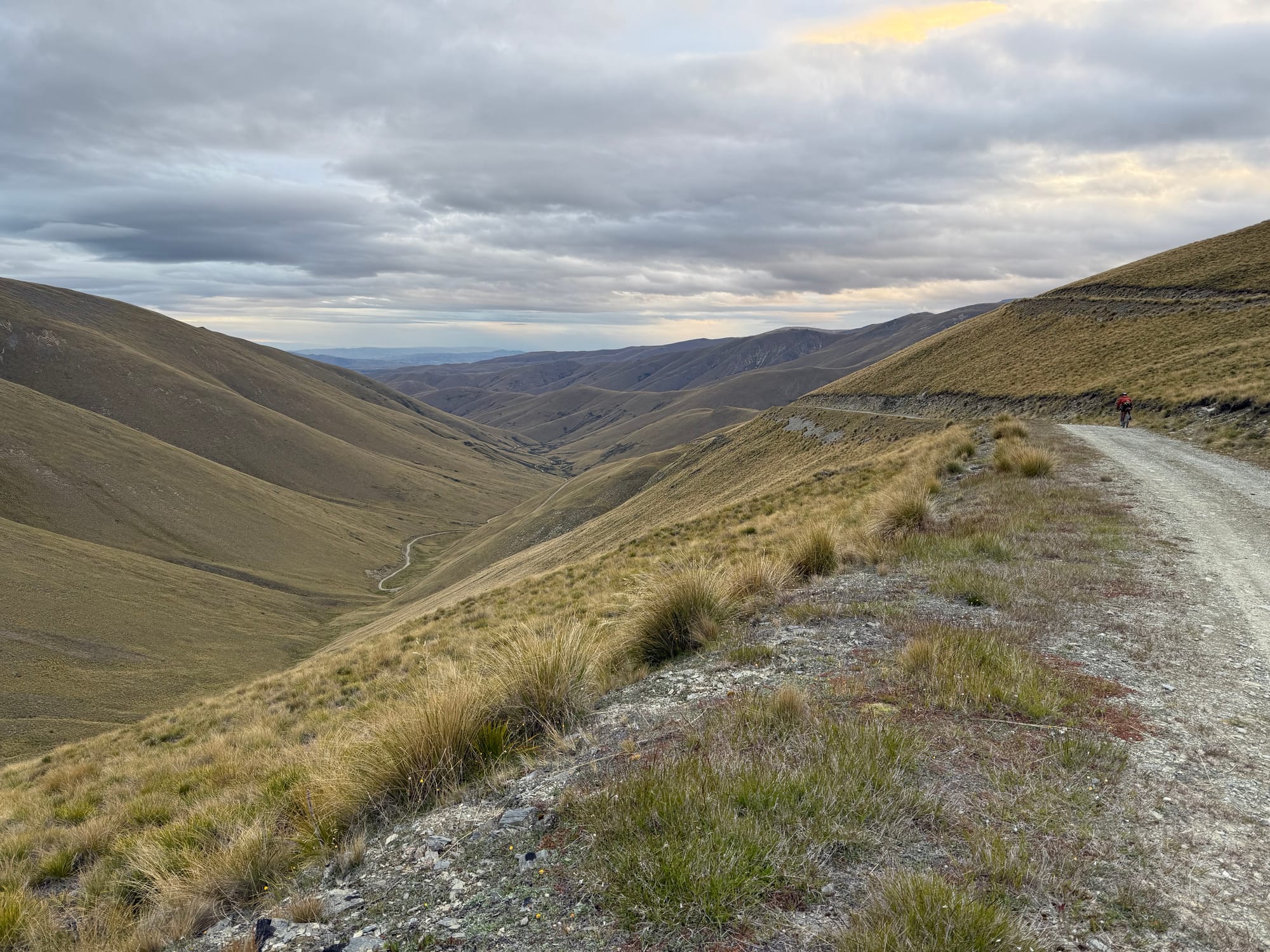
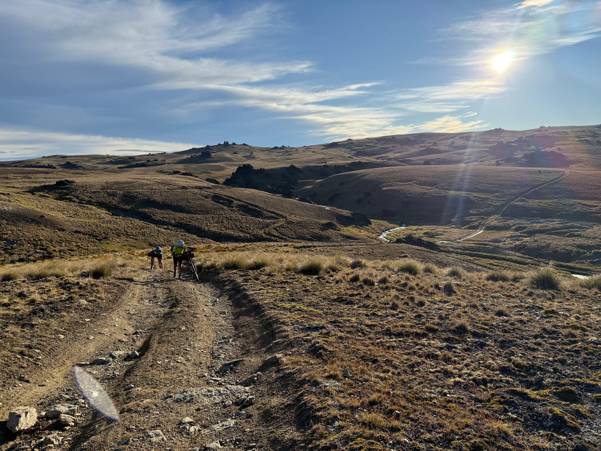
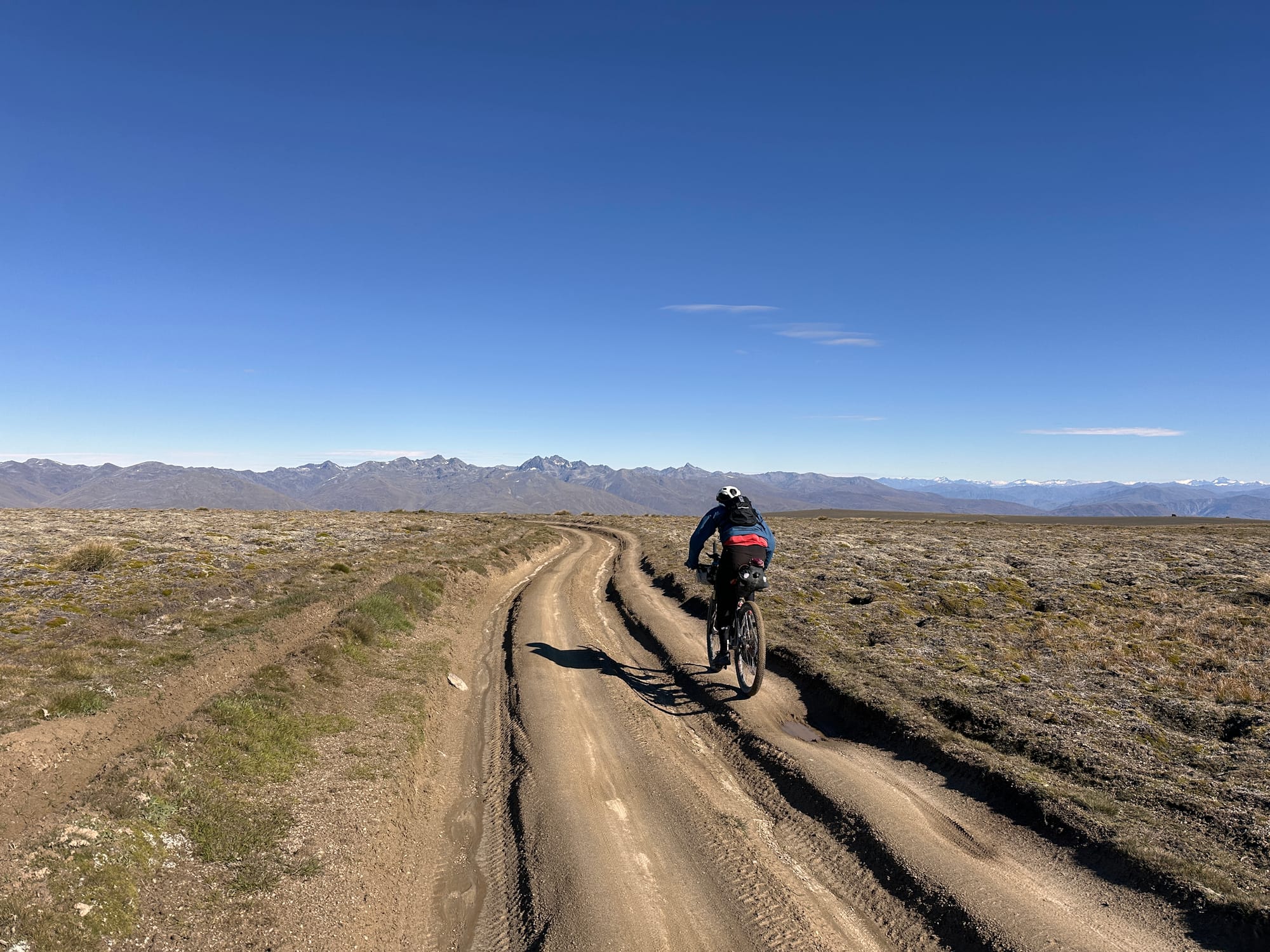
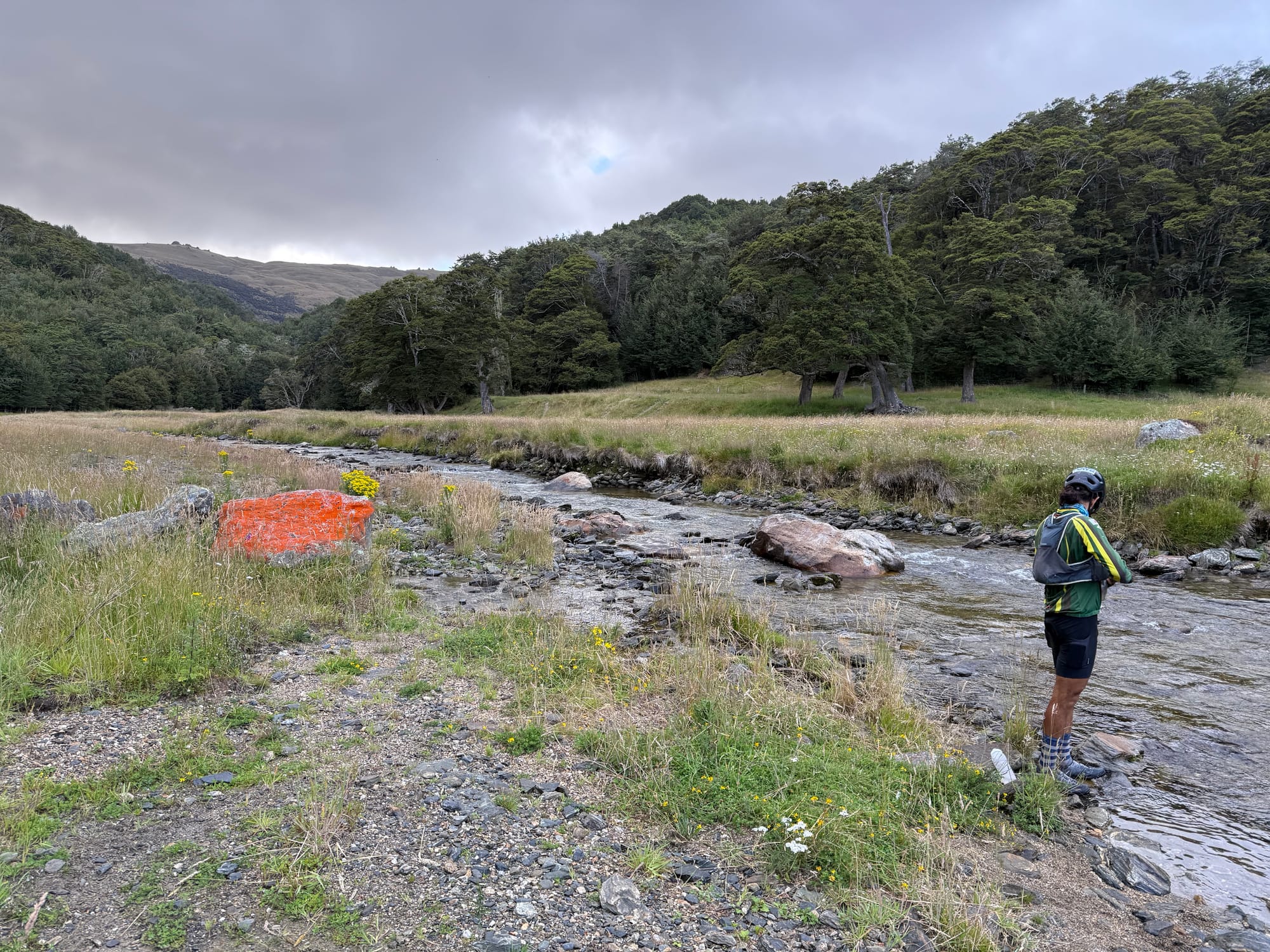
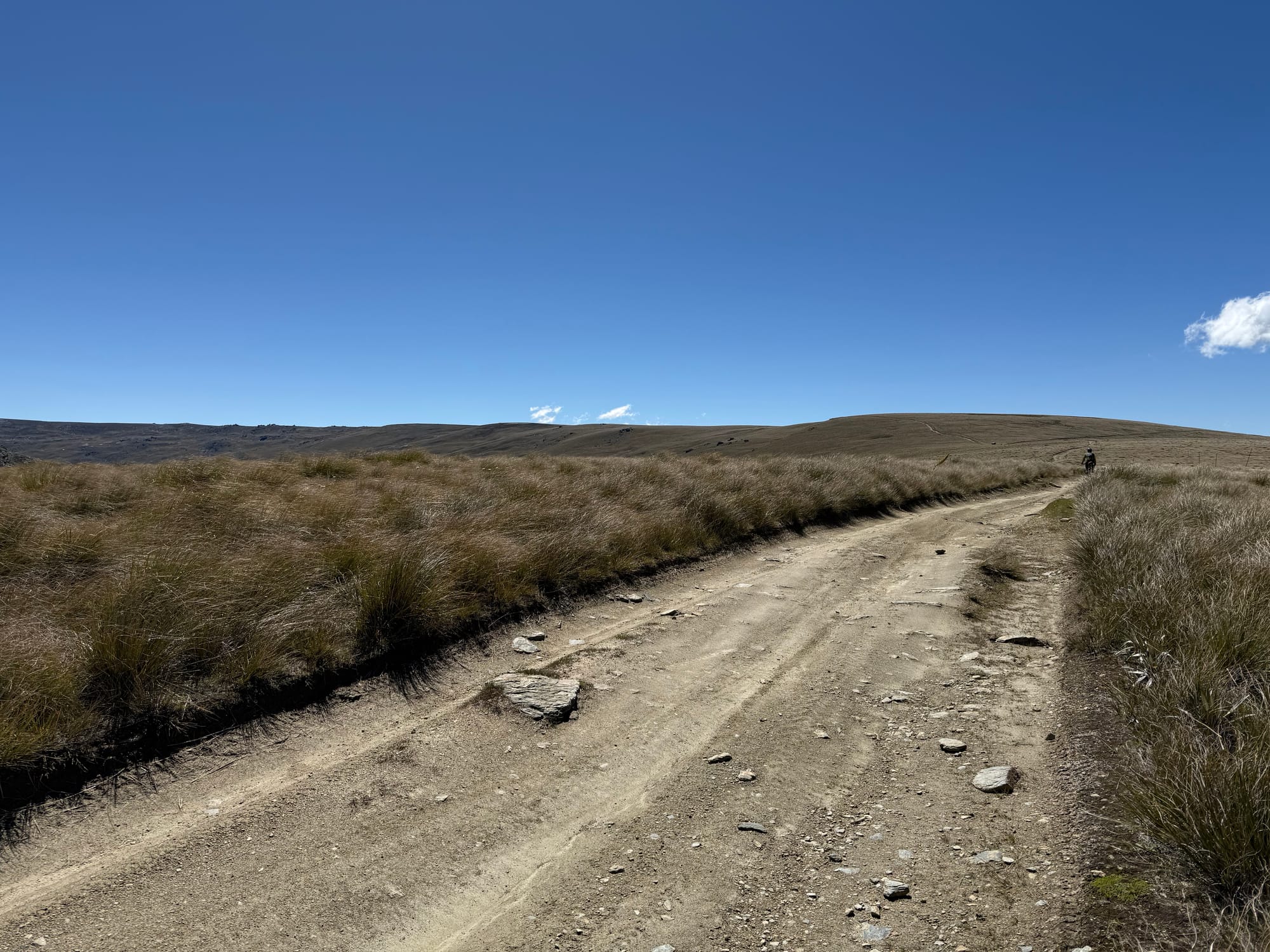
It took a lot longer than I expected to get to the proper climb up the Old Man. There was a lot of steep up and down some of which I pushed even though I didn't have to as I was having another slow start. There were still a few showers hanging around. I had never been to this part and there was a refreshing amount of beech forest.
I caught up with Daniel at the last water filling stream (he'd recommended taking plenty and I took way too much) and soon after we commenced the big push up a very steep and deeply rutted dirt 4wd track that went on seemingly forever. Eventually it tapered off and it was just semi-technical riding along the tops for a few hours. As per the Old Woman it was windy up top and I was keen to get through quickly in case it got stronger.
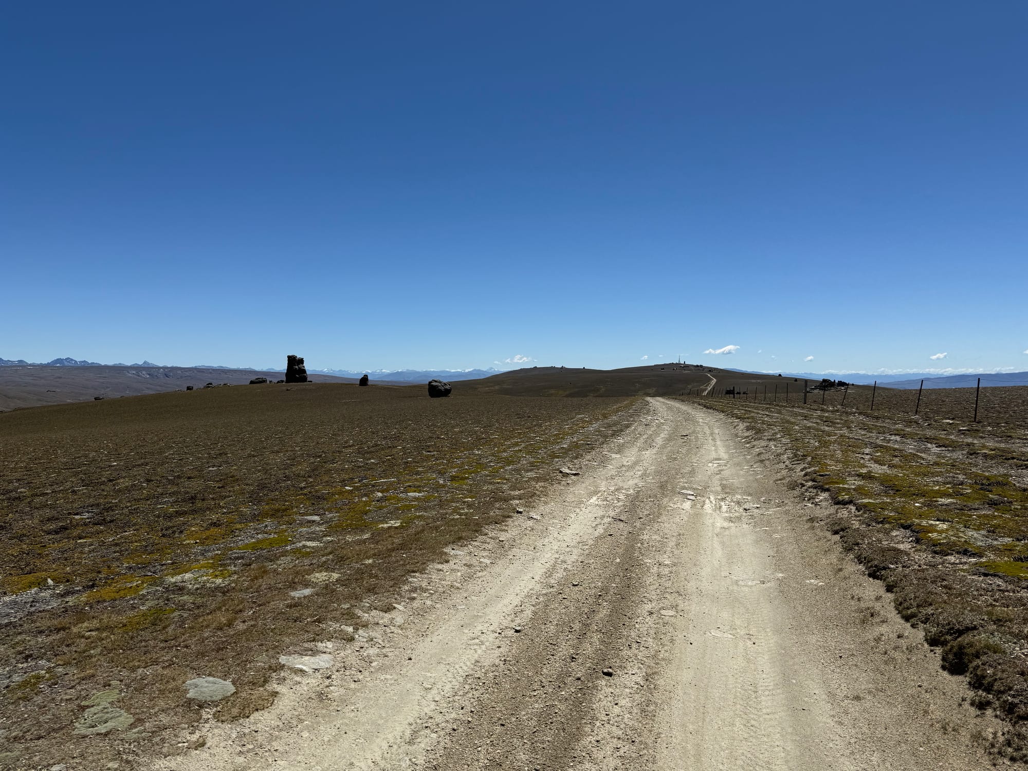
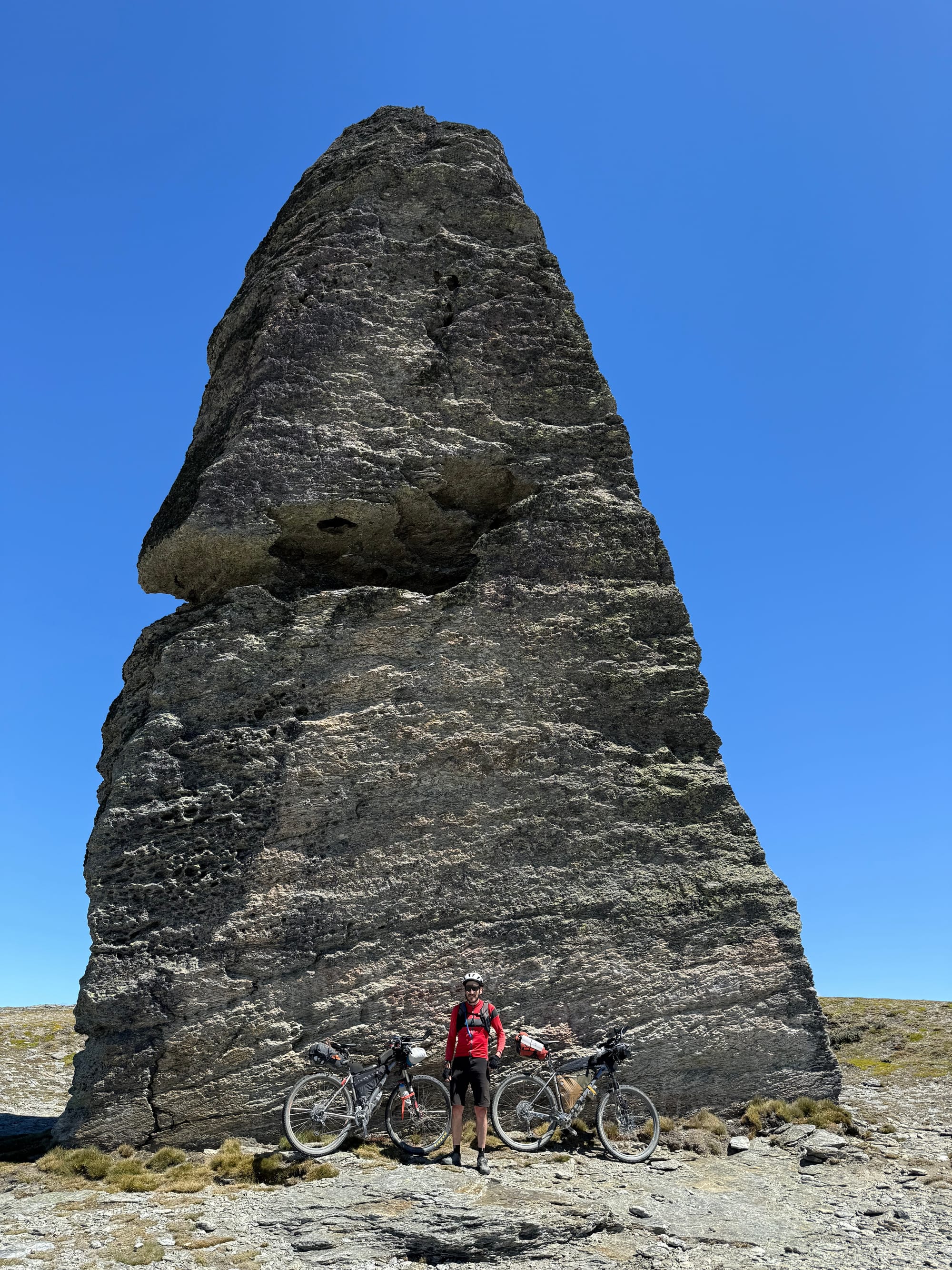
Once we got to the Obelisk it was all downhill.
We met our third trail angel in three days in the form of Matt the organiser giving out fruit and drink and directions for the next bit where others had gone wrong.
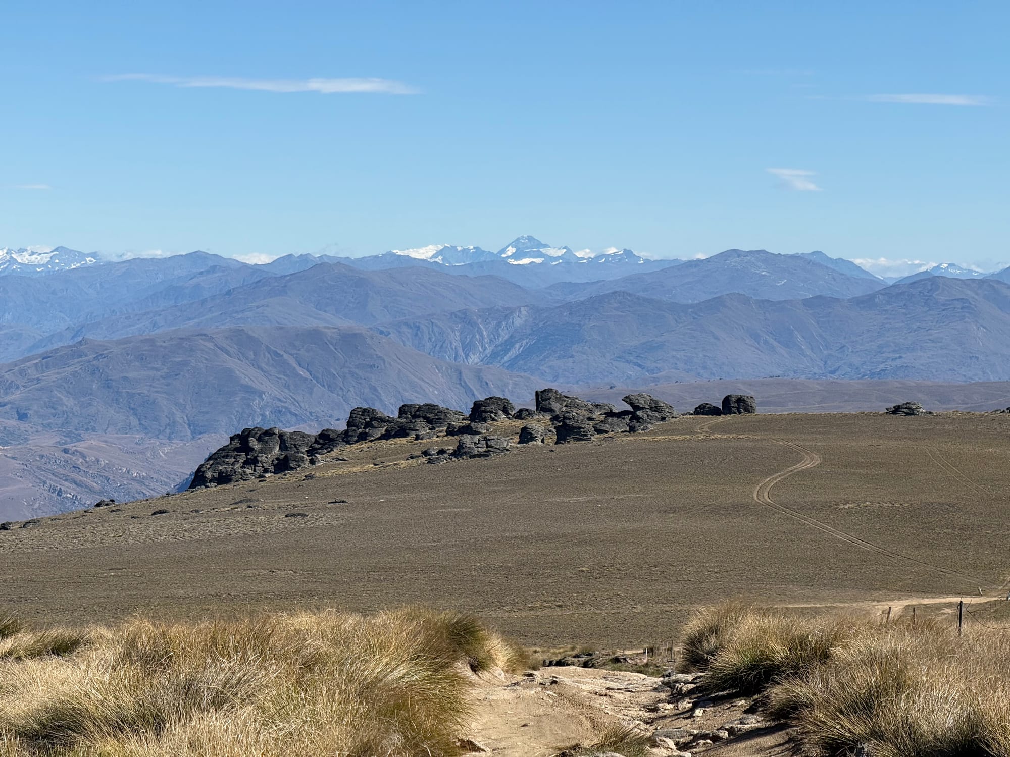
The farm track we descended was very steep and rocky at times. Steep enough that you'd drop behind the saddle. I could smell Daniel's brakes burning at one point and wondered about the fire risk of hot brake rotors around here!
On reaching tarmac the sun was baking and you could see Alexandra and sense the refreshments and food just a stones throw away. But no, the route took you up and over another hill: past Butchers Dam and up Sphinx Rock Track which took me another three hours! Most of this single track would be a lot of fun unladen with fresh legs but the tight rocky turns just meant getting off and on a fair bit. I made several time consuming navigation errors following the wrong track a few times because the GPX was so coarse.
Once at the top at Sphinx Rock itself, it was all downhill on an endless flowing single track down towards Doctors Point. I was enjoying myself enough that I let my bike leave the ground a little, both wheels, a few times. I have never done that with a loaded bike before. The fact I could do that proved my bag setup this time was far better than in the past.
On these brevets I often find places to come back to with my family and the Sphinx Rock track goes on that list. The climb would be fun with fresh legs and an unladen bike and ridable for kids confident on easier blue trails.
At the bottom I was hoping it would be a flat run into Alex but no, the Roxburgh Gorge trail here has a few switchback climbs in it. I didn't get to Alex until 6pm and Daniel was a bit ahead of me. He'd phone ordered a sit down meal at the Thai restaurant so that was a bit of a treat and surprisingly time efficient. My resupply was a struggle, slow and ineffective. I ended up visiting both supermarkets! The smaller shops are often easier.
It wasn't till after 7pm we headed off aiming for Poolburn Dam. Daniel by now just wanted to get to Tekapo. I hadn't studied this next section much so was interested to see what we would find.
There was a lot of headwinds and uphill (if relatively gentle) and by 10pm Daniel proposed camping, sheltered from the wind behind a block of rocks. My pillow (built into my sleeping mat) went down in the night which woke me and my attempts to re-inflate it probably woke Daniel in his bivvy nearby.
Day 5 stats: 140km 3300m 12:52 (moving excl pushing) 16:30 (elapsed, incl pushing).
Day 6: Near Poolburn Dam to Waipiata
A 4am-ish start had us miss seeing Poolburn Dam and the expansive views in that area we were informed of later that day. While stopping to use an unlocked long drop near the dam, another rider passed us having stayed near there and Daniel ended up riding ahead with him while I plodded at my usual slow morning pace.
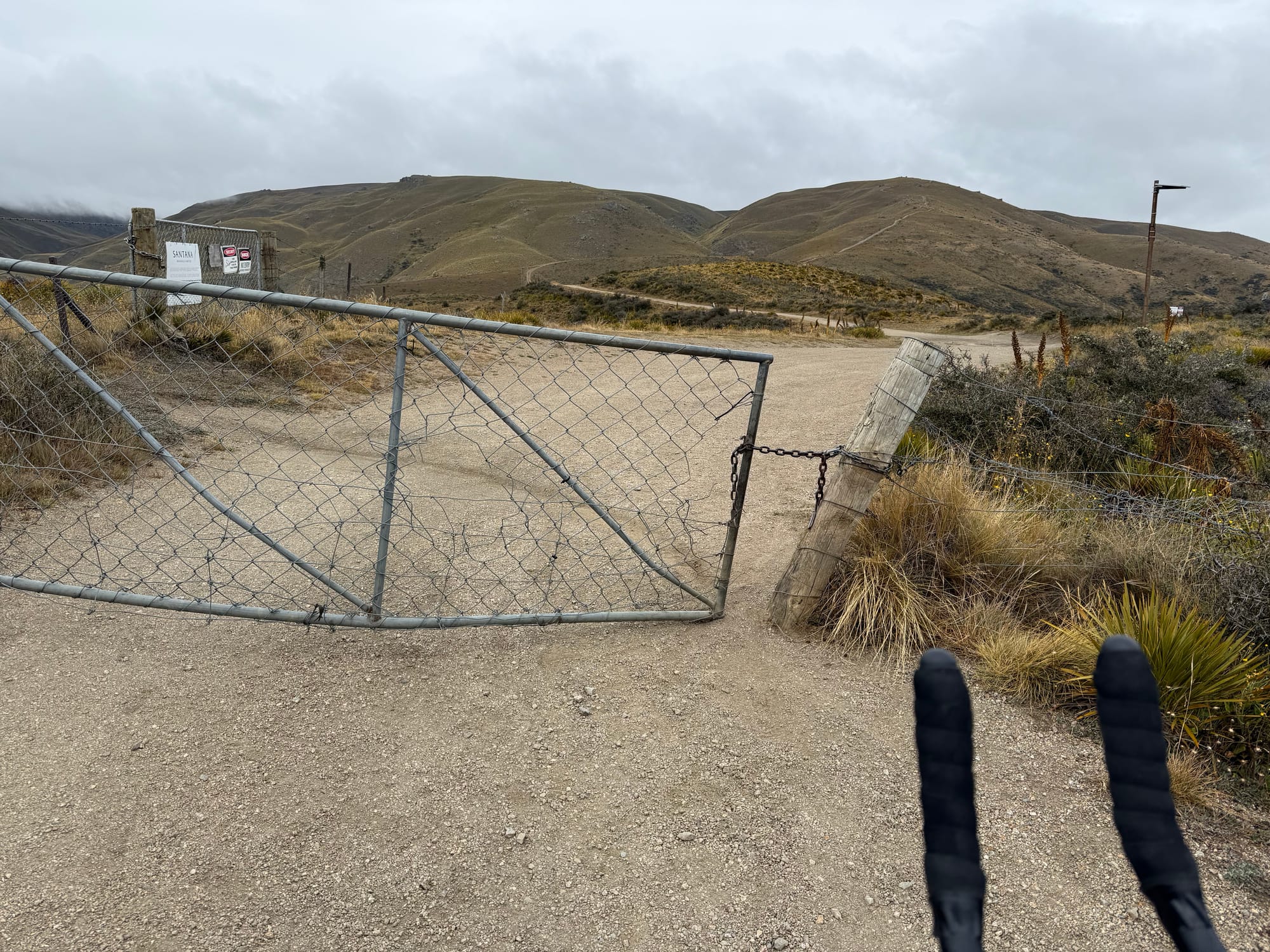
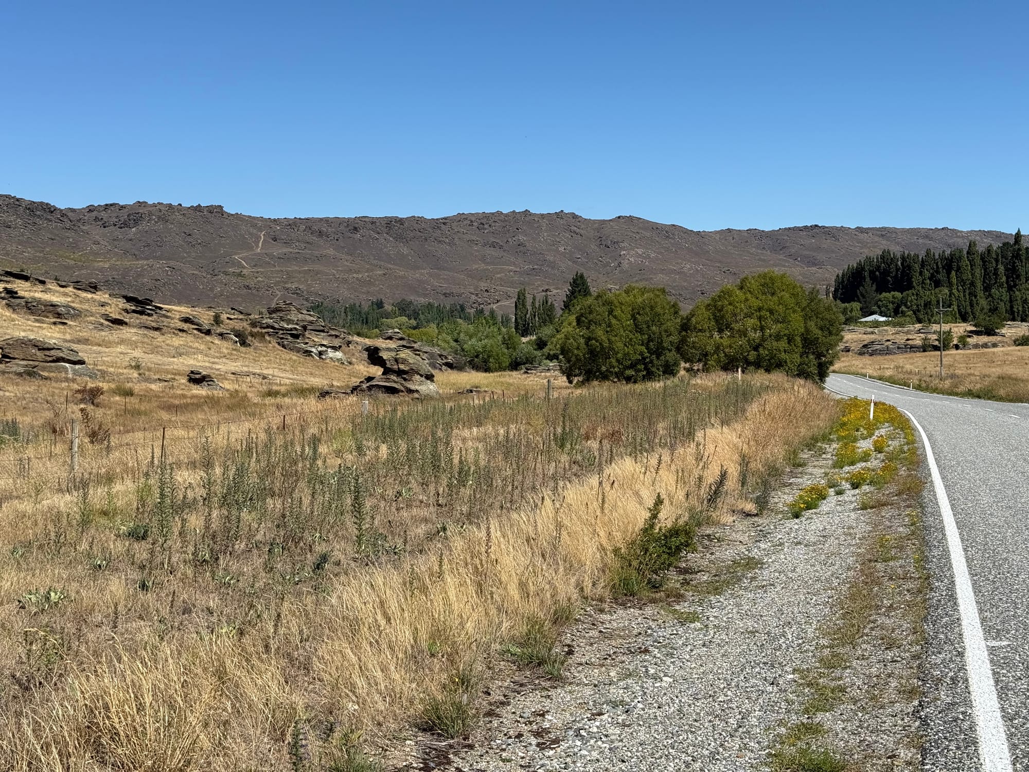
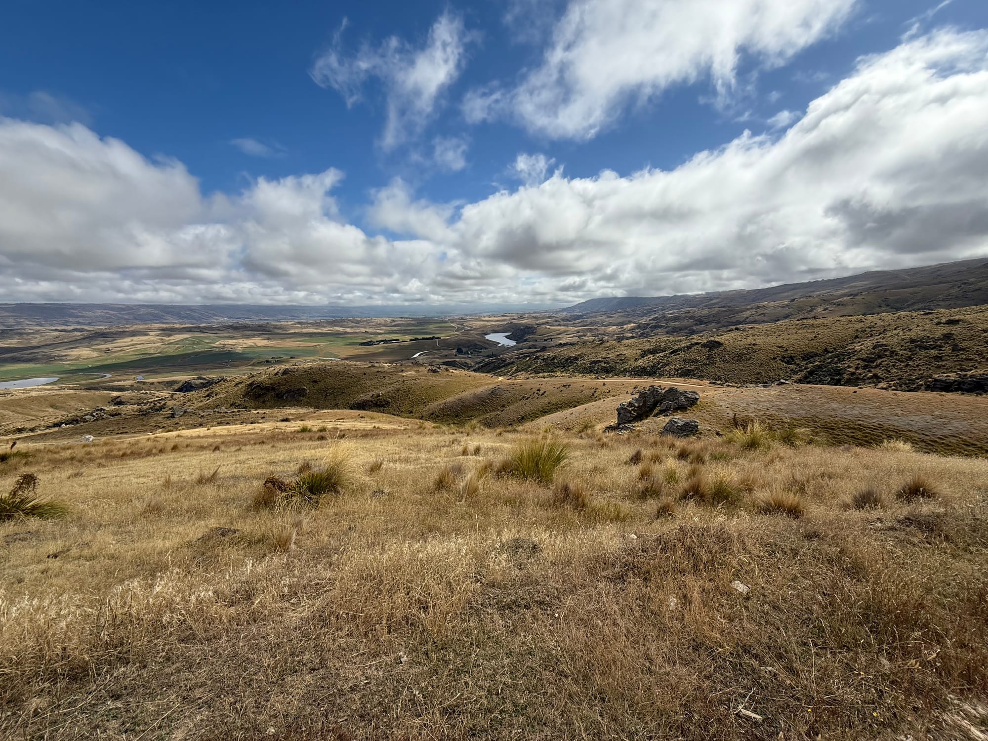
Eventually I was making my way through Purau Valley in the Upper Taeri and turned off to head up the Rock and Pillars. At the gate I changed out of my warmer clothes and while doing that opened the gate for a vehicle. Got chatting to the occupants who told me a bit of the history of the Dunstan road they were on (and other parts I'd been on that morning) as the route the early settlers and gold miners had come through.
While repacking my bike I discovered a packet of "rocky road bites" I'd picked up in Alex. They were a bit of a mystery but I figured the next big climb might make good use of them.
As it turned out they seemed to work a treat. I cruised the whole climb then caught up to the rider who we'd met that morning. He'd started the climb with Daniel who wasn't much further ahead. I powered on along the rough rutted tracks still riding mostly standing, unable to understand where the power was coming from when I caught Daniel. He suggested I continue "riding the wave". Well the packet of bites eventually ran out and I even found myself doing a little pushing at one point.
We met Dan coming back down on his bike to set up the trail angel BBQ at the jeep while Russel was waiting to join us for the remaining ride towards Middlemarch. I enjoyed chatting with him and among other things we talked about what criteria they might add to the GSB route selection as this one was particularly tough especially for newcomers.
The descent was one of the best yet and went on seemingly forever. 1400m to 300m over less than 15km. Then a tail wind along the straight bit of rail trail into Middlemarch.
That Rock & Pillars route was another "must come back and do as a day ride one day". Another highlight of this GSB for me and a nice surprise due to not picking up on it when studying the route.
For some reason we forgot about the cafe and just used the store as resupply. It wasn't great as I realised after and we'd not get to Ranfurly before the store there closed either. But a quick mental inventory I figured I was ok until Kurow.
Of course the route from Middlemarch to Ranfurly was not just via the obvious rail trail. We diverted along a parallel gravel road that went up and down all the time. I enjoyed it more than Daniel. Eventually we got back on the trail and met Russel again waiting at Hyde for a lift.
We also met a cycle touring couple we'd seen the previous day on the rail trail near Alex. They were camped by the track and had clearly been following the GSB, cheering us on.
Soon after passing them the route took a hard left up a fairly step farm track up and over a hill. Hamilton Diggings or something. Not what you are looking for after a long day but some good views and another long descent before arriving at Waipiata.
Outside the Waipiata Hotel I convinced Daniel that since we only had an easy 197km to go and given you could choose to sleep early or late we might as well stop there. My legs were pretty done. And it was the last chance for a proper meal. So we asked and got a room. Fabulous gourmet pie dinners I knew well from prior visits. The publican had heard many stories from GSB participants passing through and seemed fascinated by the whole thing.
The catch for me with Waipiata was Daniel wanted to get up even earlier of course. We negotiated and agreed on 1:45am wake up.
Day 6 stats: 169km 2900m 13:16 (moving) 16:20 (elapsed, incl pushing)
Day 7: Waipiata to Tekapo
Neither of us wanted to get up in the middle of the night. The breakfast room had plenty of food and delayed our departure as we had a bit of a midnight feast.
It didn't start getting daylight until I got to near Dansey's Pass. I was stopped to change clothing when I saw a small light approaching from behind, another rider, on a gravel bike so we rode together to and over Dansey's Pass itself. Always makes a climb pass by quickly when you're chatting.
Dylan was praising the bike shop in Invercargill that Matt Zenovich (famous, with me at least, for his Tuatara 1000 exploits) is involved with and how they help out the cycling community but it also turned out that his brake pads were down to the metal due to all the epic descents. The bike shop mechanic had said they were half way and would be "fine" (!). Not sure why he had no spares though.
Once we got to the bridle path farmland detour, Dylan was walking the descents to protect his rotors. I wasn't in a hurry and largely matched his pace. Once on a normal road he sped off into the distance.
Arriving at the A2O trail I checked the map progress and found Scott was near Kurow. I was hoping he'd have a nice long cafe stop and we'd be able to ride to the end together. When I got there Scott was sitting in the cafe with Dylan and had already given him his spare set of brake pads that happened to match his GRX system!
Once refuelled and resupplied Scott and I set off together and it was great to catch up as we went along. In GSB21 we had basically parted ways at Kurow as I was so keen to get to Tekapo before dark.
The sun was pretty hot up the Hakataramea Valley with light wind conditions.
Once we descended to Haldon Road it all changed, as per 2021 and, I expect typical for late afternoon, strong cross and head winds all the way to Dog Kennel Corner, It took what seemed like an eternity.
Last time I remember this all being a nice tailwind once hitting the highway after the Corner but this time we have a separate sandy cycle trail and either the rolling resistance of that or the lack of tailwind it was still slow going.
We didn't get to Tekapo till 7-8ish but we had a nice welcome with Matt, Karl and Andy there to greet us.
Reflections
- Chamois Free! Despite pulling out of GSB2023 due to saddle sore bad enough I couldn't sit, I committed to no chamois this time. My newish Ergon SMC Core saddle didn't feel right with one. Anyway my nether region was in by far the best condition after a full length brevet ever. This was huge for me as I've wanted to ditch the chamois for years.
- Best ever bike bag setup. I've been plagued with front roll tyre buzzing issues all along and usually ended up hitching it up on the aero bars. This time I worked harder to pack the frame bag densely by putting things tightly into pouches and keeping the front very light. It worked extremely well and improved the experience a lot while using the same bags I've had for years.
- Backpack/vest for hydration worked pretty well. I had a CamelBak branded one which lacked resupply expansion space and had weak zips, one of which broke. (fortunately the store took it back but I'll get something similar to replace it).
- Chocolate as part of the fuel mix seems to work for my body but still had flat patches. I think I ate too much food at once a few times, especially breakfast.
- This GSB was great for those, like myself, fairly experienced and wanting a challenge. But the GSB routes were designed to be modified by participants (like a flower, inviting chopping off petals) and this edition a large part of the field did so and still had a good time.